
See all 31 routes on Erie Canal
New York | Erie and Niagara Counties / Western New York
Erie Canal
Ransom Creek Kayak Launch, Amherst to Nelson C. Goehle Public Marina, Lockport
Route planning details, access notes, and local verification guidance.
Route location
Loading the route coverage map.
Need to know
Why this call
Conditions
Gauge history and hourly forecast
Use the gauge context and hourly forecast to verify local conditions before launching.
Gauge detail
Gauge history & hourly forecastDetailed view
Gauge
Recent trend
Checking preferred range.
Checking trend.
Gauge source
--Checking timestampMN DNR provides the current paddling level here, but not chart-ready recent samples.
Weather
Hourly forecast
Checking weather.
Loading today's forecast.
Next 8 hours
Short-route forecast
Checking the next several hours.
Route overview
Quick facts and what's next
Distance, difficulty, shuttle basics, and the near-term outlook before you commit to the drive.
Quick facts
Plan ahead
Upcoming outlook
These are early planning reads. Re-check live conditions before you commit to the drive.
Waiting on forecast.
Waiting on forecast.
Plan
Plan your trip
Launch points, shuttle details, distance, and access notes.
Route logistics
Access and shuttle
A 9.38-mile one-way Erie Canal Water Trail trip from the Ransom Creek Kayak Launch in Amherst to Nelson C. Goehle Public Marina in Lockport. The official Canalway itinerary describes the descent toward the Niagara Escarpment and the staircase Locks 34/35, with a low dock near the top of Lock E35. The guidebook identifies the Ransom Creek beach landing, Amherst Marine Center, the Lockport Upper Terminal launch, the strong current and traffic around Lock E35, and the concrete marina/kayak launch at the finish. This remains planning-only because the current Tonawanda Creek gauge is a downstream proxy and the route depends on canal operations, portage/lockage instructions, bridge status, and current dock access.
Plan a shorter segmentOptional
Access planner
Pick a shorter segment
This changes launch and take-out logistics, not today's river score.
Peltier Lake to Long Lake is the full route. Shorter access pairs are useful when wind, time, or group energy changes the plan.
Prepare this trip
Take the plan with you
Download the canonical route, add a calendar hold, or send a simple float plan to your group.
Put-in
Ransom Creek Kayak LaunchThe stored coordinates follow the Canalway guide’s named public launch and marina anchors; the private Amherst Marine Center is retained as a navigation reference only and not as public access.
Take-out
Nelson C. Goehle Public Marina / Wide Waters MarinaThe route may require a current lock-through or portage decision at E35/E34. Do not enter a lock, spillway, hydraulic race, or maintenance property without explicit current instruction.
Plan this segment
Pulling access map tiles. Usually under 5 seconds.
Access caveats and watch for
Access caveats
- The stored coordinates follow the Canalway guide’s named public launch and marina anchors; the private Amherst Marine Center is retained as a navigation reference only and not as public access.
- The route may require a current lock-through or portage decision at E35/E34. Do not enter a lock, spillway, hydraulic race, or maintenance property without explicit current instruction.
- Vertical canal walls and the deep cut limit improvised exits. The Lockport Upper Terminal is the documented bailout/portage boundary; verify the approach and safe carry before relying on it.
- The route ends at Nelson C. Goehle Public Marina. Continuing beyond it or navigating the Lockport Flight as a separate route requires a new access and hazard review.
Watch for
- USGS 04218000 unavailable, rapidly changing, or inconsistent with local canal/tributary conditions
- Canal level, wakes, bridges, Guard Gates, vertical walls, cold water, debris, commercial traffic, Locks E35/E34, hydraulic race, spillway, hydroelectric plant, and lock/portage instructions
- Ransom Creek parking/carry, Upper Terminal approach, Nelson Goehle marina authorization, docking, overnight parking, shuttle staging, and current Canal Corporation notices
Route gallery
See this route on the water
Photos help show what the access looks like and what the route actually feels like on the water.
Score & sources
Data and sources
See the gauge, weather, and source notes behind today's call.
Why this scoreToday's evidence strength is checking
Evidence strength mostly comes down to three things: how direct the active gauge is, how clear the range is, and how fresh the data is.
- Checking evidence-strength notes.
- Checking evidence cautions.
Data behind the scoreGauge, thresholds, and timing
These are the live readings and threshold notes behind today's score.
| Gauge site | Tonawanda Creek at Rapids, NY |
| Discharge | Checking |
| Gauge height | Checking |
| 24h trend | Checking |
| 24h change | Checking |
| Current band | Checking |
| Rain last 24h | Checking |
| Rain last 72h | Checking |
| Air temp | Checking |
| Water temp | Checking |
| Wind | Checking |
| Gusts | Checking |
| Rain timing | Checking |
| Ideal range | Needs paddler reports |
| Known low-water floor | Not calibrated yet |
| High threshold | Not calibrated yet |
| Evidence strength behind the range | Official and local sources |
| Gauge observed | Checking |
| Paddle Today updated | Checking |
| Main source behind this score | No numeric go/no-go threshold published for the Ransom Creek to Nelson Goehle trip; use USGS 04218000 as downstream Tonawanda Creek proxy context plus local canal/lock inspection |
| Gauge source | Checking |
| Weather source | Checking |
| Rainfall source | Checking |
NotesWhat to know before you go
These notes cover the access details, route quirks, and source caveats most likely to matter once you get there.
- Named Canalway day tripRansom Creek Kayak Launch to Nelson C. Goehle Public Marina; 9.38 miles; two locks
The official Erie Canalway day-trip page publishes the route endpoints, mileage, lock count, Niagara Escarpment descent, and Lockport destination.
- Public endpoint and Lockport accessRansom Creek beach landing; Lockport Upper Terminal; Nelson C. Goehle concrete/kayak launch
The Canalway guide identifies the public launch, the Upper Terminal portage/bailout context, the Lock E35 hydraulic hazards, and the endpoint marina facilities.
- Lock, bridge, and navigation rulesCurrent lock-through/portage instructions required at E35/E34; bridge and Canal Corporation notices control operations
The state Canal Corporation publishes current boating information, lock procedures, and Notice to Mariners alerts; check them immediately before departure.
- Proxy live gaugeUSGS 04218000 Tonawanda Creek at Rapids
USGS provides downstream watershed trend context; canal levels and lock/hydraulic operations are not represented by a numeric route threshold.
- Camping postureNearby managed basecamp only; endpoint overnight parking is not a camping claim
Confirm any current marina or campground authorization separately; do not infer camping from overnight parking.
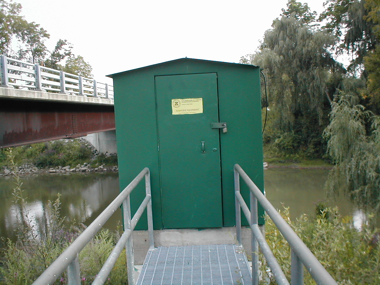
- Route imageUSGS Tonawanda Creek proxy station photograph used as clearly labeled watershed context
The presentation image is proxy context and does not claim to depict the Ransom Creek-to-Lockport canal reach.
- Same-river proxy gaugeUSGS 04218000, Tonawanda Creek at Rapids, NY
USGS 04218000 at Rapids is downstream on Tonawanda Creek, outside the canalized Ransom Creek-to-Lockport reach. It provides regional watershed trend context, but canal pool levels, lock operations, bridges, hydraulic structures, and local navigation notices dominate; no numeric route threshold is claimed.
- Safety and river conditionsCheck live gauge, recent rainfall, trend, debris, bridges, and access conditions before launch
Erie Canalway National Heritage Corridor Western Erie Water Trail and its linked safety material warn that conditions change rapidly and require local inspection.
- Image decisionApproved watershed/proxy-gauge context image used for route presentation
The image is clearly labeled as watershed/proxy-gauge context and does not claim to depict this exact reach.
Verify it yourselfCheck the source links
Use these links to double-check the gauge, route details, and access notes before you head out.
- Erie Canalway National Heritage Corridor Western Erie Water Trail route record
- NYS Canalway Water Trail Erie Canal–Amherst and Lockport guidebook map
- USGS 04218000 Tonawanda Creek at Rapids current stage and discharge proxy
- Erie Canalway Water Trail safety guidance
- USGS 04218000 monitoring location
- USGS 04218000 current conditions
- Erie Canal context image
Paddler reports
Recent notes from paddlers
A few quick notes from people who were on this route recently.
Reports
Paddler reports
See recent photos and notes from people on the route.
Share your trip
Keep exploring
More routes to check next
Compare another stretch on this river, or jump to nearby options before you pick a plan.
More in New York
All 296 routesMore on Erie Canal
All 31Nearby routes by distance
Quick answers
Erie Canal paddling FAQ
What water level is good for paddling Erie Canal?
Paddle Today watches Tonawanda Creek at Rapids, NY and uses Not calibrated yet as the conservative low-water floor for this route. The ideal range still needs more paddler reports.
Where does this Erie Canal route start and end?
This route starts at Ransom Creek Kayak Launch and ends at Nelson C. Goehle Public Marina / Wide Waters Marina, about About 9.38 Canalway miles one way from Ransom Creek Kayak Launch to Nelson C. Goehle Public Marina on the water.
Is this Erie Canal route good for beginners?
This is listed as a moderate route. Expect more planning than an easy float, and use the live score, route notes, and source links before committing.
Flag a change
See something outdated?
Access, hazards, wood, and shuttle details change. Send a quick correction if something looks off.