State routes

New York Rivers

Compare 133 tracked New York paddle routes with route links, water-level context, difficulty, and access planning details.

Paddle Today only lists routes when the gauge, threshold, and source support are defensible enough for live route scoring.

133 routes72 rivers261 regions37 beginner routes

Loading supported rivers and route reaches.

Explore supported New York rivers

Scan the highlighted river network from above, then use the route guides and access markers to find a supported reach.

133 route markers30 multi-route rivers37 beginner routes
Supported riverSelected reach80Paddle · Strong60Tradeoffs40Skip today

Best New York routes today

Loading current scores, gauge reads, and weather signals.

--Live
Washington County

Batten Kill

Battenville NY Route 61 access to Clarks Mills / Rexleigh lower-falls access

Easy | 8 river miles (route source estimates 6 mi; endpoint anchors span 7.4 mi straight-line) | 2–3 hours depending on flow, current, group pace, breaks, and shuttle timing
View route
--Live
Steuben County / Corning

Chemung River

Cohocton Street Launch to Bottcher's Landing

Easy | 6 river miles | 3–5 hours depending on flow, current, group pace, breaks, and shuttle timing
View route
--Live
Chemung County / Elmira to Chemung

Chemung River

Elmira Chemung River public access area to White Wagon Park, Chemung

Easy | Approximately 12.5 planning river miles by current endpoint geometry from the Elmira public access area to White Wagon Park in Chemung; the route source labels the section 10 miles | About 5–7 hours depending on flow, current, shallow sections, breaks, group pace, and shuttle timing
View route
--Live
Chenango and Broome Counties

Chenango River

Greene River Access to Chenango Forks Route 12 Bridge

Easy | 12 river miles | 4–6 hours depending on flow, current, group pace, breaks, and shuttle timing
View route

This panel hydrates from live Paddle Today scores. The route links above remain useful when JavaScript or the score API is unavailable.

Good starting points in New York

Ranked from route metadata, source support, difficulty, and logistics.
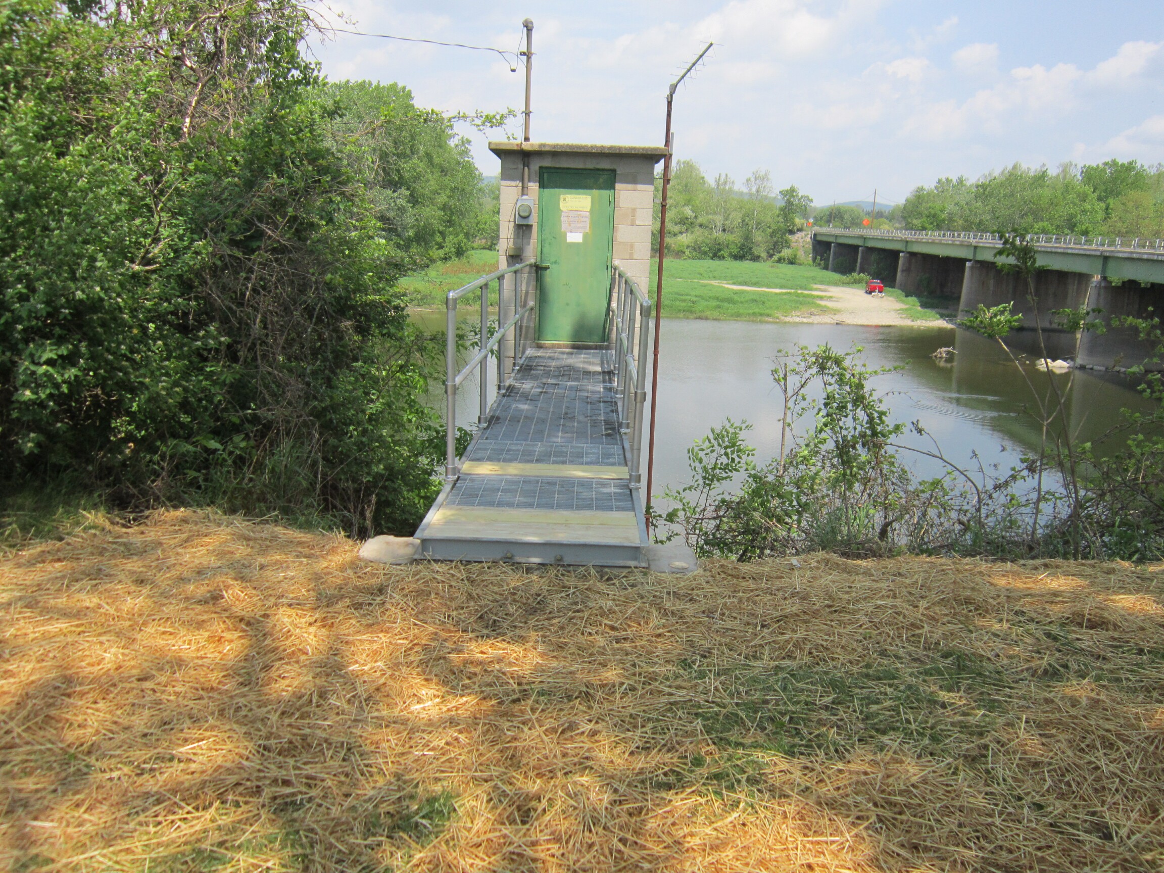
The Batten Kill at the USGS Battenville monitoring station in New York.
New York routeWashington CountyBatten KillBattenville NY Route 61 access to Clarks Mills / Rexleigh lower-falls accessA six-mile Class I Batten Kill route from the Battenville NY Route 61 access to the Clarks Mills/Rexleigh lower-falls access. The corridor adds a distin...

Route facts

Easy | 8 river miles (route source estimates 6 mi; endpoint anchors span 7.4 mi straight-line) | 2–3 hours depending on flow, current, group pace, breaks, and shuttle timingmixed source support
The Chemung River flows through downtown Corning, New York, beneath the Centerway Walking Bridge.
New York routeSteuben County / CorningChemung RiverCohocton Street Launch to Bottcher's LandingShorter options: 2.8–3.2 miAn easy-to-moderate Chemung River route from downtown Corning’s Cohocton Street Launch through River Road to Bottcher’s Landing. The published itinerary...

Route facts

Easy | 6 river miles | 3–5 hours depending on flow, current, group pace, breaks, and shuttle timingmixed source support
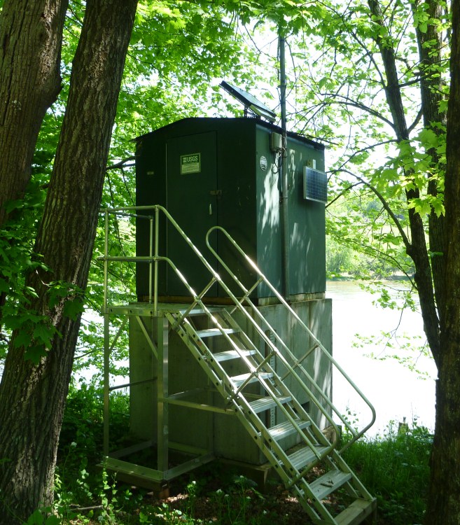
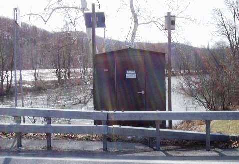
Chemung River at Chemung, New York, in the USGS station photograph used as direct same-river context for the Elmira-to-Chemung route.
New York routeChemung County / Elmira to ChemungChemung RiverElmira Chemung River public access area to White Wagon Park, ChemungA planning-only Class I Chemung River route from a current Elmira public hard-surface access area to the current White Wagon Park launch in Chemung. Can...

Route facts

Easy | Approximately 12.5 planning river miles by current endpoint geometry from the Elmira public access area to White Wagon Park in Chemung; the route source labels the section 10 miles | About 5–7 hours depending on flow, current, shallow sections, breaks, group pace, and shuttle timingmixed source support
The Chenango River flows beneath Court Street Bridge in Binghamton, New York.
New York routeChenango and Broome CountiesChenango RiverGreene River Access to Chenango Forks Route 12 BridgeA long, easy Chenango River route from the Greene public launch to the Chenango Forks Route 12 access near the Tioughnioga confluence. The corridor has...

Route facts

Easy | 12 river miles | 4–6 hours depending on flow, current, group pace, breaks, and shuttle timingmixed source support
Kayakers paddle the Cohocton River through the Southern Tier of New York.
New York routeSteuben County / Southern TierCohocton RiverBabcock Hollow Road launch near Bath to Campbell Cohocton River accessShorter options: 2.3–6.7 miA nine-mile Class I Cohocton River day trip from the officially designated Babcock Hollow Road launch near Bath to the Campbell access area. The route i...

Route facts

Easy | About 9 river miles from the Babcock Hollow Road launch near Bath to the Campbell access area | About 4 hours depending on flow, shallow-water carries, group pace, breaks, and shuttle timingmixed source support
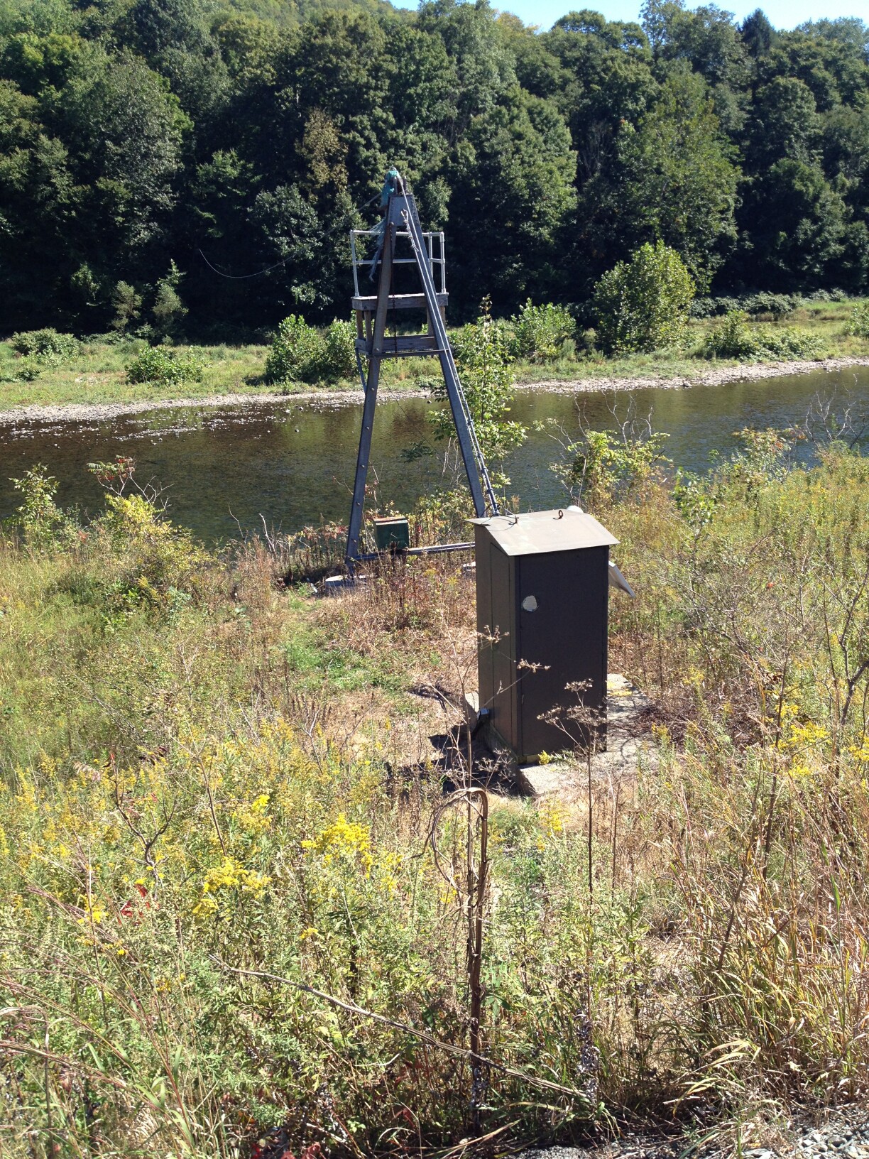
The Delaware River at the USGS Callicoon monitoring station in the Upper Delaware corridor.
New York routeOrange County, New York / Pike County, PennsylvaniaDelaware RiverWest End Beach / Port Jervis Tri-States access to Milford Beach, PennsylvaniaAn eight-mile Class I Delaware River route from Port Jervis, New York, to the NPS Milford Beach access in Pennsylvania. The corridor adds a distinct low...

Route facts

Easy | 8 river miles | About 3.5 hours depending on flow, current, group pace, breaks, wind, and shuttle timingmixed source support

New York beginner routes

These routes are tagged easy in the route data. Today's water can still change the call.

Showing 8 of 37 beginner routes. Use the Easy difficulty filter below to see the full set.

Routes with practical logistics

Use the live weekend board for score-based recommendations.

Rivers and regions

Compact directory links for crawlers and planners.

By river

Hudson River8
Susquehanna River7
Genesee River6
Schoharie Creek5
Chemung River4
Chenango River4
Delaware River4
Black River3
Cazenovia Creek3
Peconic River3
Raquette River3
Salmon River3
Wallkill River3
West Branch Delaware River3
Allegheny River2
Batten Kill2
Cattaraugus Creek2
Chittenango Creek2
Cohocton River2
Esopus Creek2
Kinderhook Creek2
Mohawk River2
Oak Orchard Creek2
Oatka Creek2
Otselic River2
Sacandaga River2
Schroon River2
Tioughnioga River2
Unadilla River2
West Branch St. Regis River2
Allens Creek1
Anthony Kill1
Beaver Kill1
Black Creek1
Boquet River1
Buffalo River1
Canisteo River1
Catatonk Creek1
Catharine Creek1
Cobleskill Creek1
Croton River1
East Branch Delaware River1
East Branch Oswegatchie River1
East Canada Creek1
East Kill1
Eighteenmile Creek1
Fall Creek1
Fishing Brook1
Flint Creek1
Honeoye Creek1
Hoosic River1
Independence River1
Indian River1
Jessup River1
Keuka Outlet1
La Chute River1
Lake Champlain1
Mongaup River1
Moose River1
Neversink River1
Niagara River1
Onondaga Creek1
Oriskany Creek1
Owego Creek1
Rondout Creek1
Salmon Creek1
South Branch Moose River1
South Branch West Canada Creek1
South Sandy Creek1
Tioga River1
Wappinger Creek1
West River1

By region

Albany and Rensselaer Counties0
Bronx County / New York City0
Broome County2
Broome County / Chenango Bridge and Port Dickinson0
Broome County / Chenango Forks and Port Crane1
Broome County / Fenton and Chenango Bridge1
Broome County / Southern Tier1
Cattaraugus County / Allegany and Olean1
Cattaraugus County / Olean and Portville1
Cattaraugus County / Zoar Valley and Gowanda1
Cattaraugus and Chautauqua Counties1
Cayuga County / Northern Montezuma WMA0
Cayuga County / Seneca River and Erie Canal approach to Cross Lake0
Chautauqua County / Jamestown0
Chemung County / Elmira to Chemung1
Chemung and Tioga Counties1
Chenango County1
Chenango County / Bainbridge and Afton1
Chenango County / Guilford and Rockdale area1
Chenango County / Southern Tier0
Chenango and Broome Counties1
Chenango and Broome Counties / Afton and Nineveh0
Chenango and Delaware Counties1
Chenango and Otsego Counties / New Berlin and Mount Upton area0
Clinton County / Cadyville, Morrisonville, and Plattsburgh0
Clinton County / Keeseville and Ausable0
Clinton County / Morrisonville and Plattsburgh0
Clinton County / Plattsburgh and Lake Champlain0
Clinton County / Taylor Pond Wild Forest0
Clinton County / northern Lake Champlain1
Columbia County / Germantown and Clermont0
Columbia County / Stuyvesant, Stuyvesant Falls, and Stockport1
Cortland County1
Cortland County / Southern Tier1
Cortland and Broome Counties / Southern Tier1
Delaware County2
Delaware County / Deposit and Hale Eddy1
Delaware County / Downsville to Shinhopple1
Delaware County / Hancock and Lordville0
Delaware County / Hancock and Upper Delaware1
Delaware County / Lordville and Long Eddy0
Delaware County, New York / Wayne County, Pennsylvania1
Delaware and Chenango Counties1
Delaware and Sullivan Counties / Hancock, Lordville, Long Eddy, and Callicoon1
Dutchess County / Hudson River tidal estuary0
Dutchess County / Hudson Valley1
Erie County / Buffalo Southtowns1
Erie County / Buffalo and West Seneca1
Erie County / Buffalo waterfront0
Erie County / City of Buffalo1
Erie County / Tonawanda0
Erie County / West Seneca and Buffalo1
Erie and Niagara Counties / Western New York0
Essex County / Adirondack Park0
Essex County / Elizabethtown and Lewis0
Essex County / Keene and Elizabethtown0
Essex County / Lewis and Willsboro0
Essex County / Ticonderoga1
Essex County / Upper Schroon River0
Essex County / Willsboro1
Essex and Clinton Counties / Adirondack Park0
Essex and Franklin Counties / Bloomingdale area0
Essex and Hamilton Counties1
Finger Lakes / Ontario and Wayne Counties0
Franklin County / Adirondack Park0
Franklin County / Onchiota / Kushaqua Conservation Easement0
Franklin County / Paul Smiths / Debar Mountain Wild Forest0
Franklin County / Santa Clara0
Franklin County / Santa Clara and St. Regis Falls0
Franklin County / Saranac Lake and McKenzie Mountain Wilderness0
Franklin County / St. Lawrence County North Country0
Fulton and Montgomery Counties0
Genesee and Monroe Counties / Western New York1
Greene County / Catskill Hudson estuary0
Greene County / Catskill village0
Greene County / Catskills1
Hamilton County / Blue Mountain Wild Forest1
Hamilton County / Blue Mountain Wild Forest and Essex Chain Lakes Complex1
Hamilton County / Ferris Lake Wild Forest0
Hamilton County / Ferris Lake Wild Forest / Piseco Outlet0
Hamilton County / Ferris Lake Wild Forest and Silver Lake Wilderness0
Hamilton County / Lake Pleasant and Indian Lake1
Hamilton County / Moose River Plains Wild Forest0
Hamilton County / Sargent Ponds Wild Forest0
Hamilton County / Sargent Ponds Wild Forest / Adirondack lakes0
Hamilton County / Siamese Ponds Wilderness0
Hamilton County / Silver Lake Wilderness0
Hamilton County / Speculator Tree Farm and Lake Pleasant0
Hamilton County / Speculator and Lake Pleasant0
Hamilton and Essex Counties / Blue Mountain Wild Forest and Essex Chain Lakes Complex0
Hamilton and Fulton Counties1
Hamilton and Herkimer Counties / Ferris Lake Wild Forest0
Hamilton and Herkimer Counties / Moose River Plains1
Hamilton, Essex, and Warren Counties1
Hamilton, Franklin, and St. Lawrence Counties / Adirondack Park0
Herkimer County0
Herkimer County / Black River Wild Forest0
Herkimer County / Black River Wild Forest / Atwell0
Herkimer County / Frankfort, Ilion, Herkimer, Mohawk, and German Flatts0
Herkimer County / McKeever and Thendara1
Herkimer County / Mohawk Valley1
Herkimer County / Poland and Middleville0
Herkimer and Lewis Counties / Adirondack Park0
Herkimer and Montgomery Counties / Mohawk Valley1
Herkimer and Montgomery counties / German Flatts, Little Falls, Fort Plain, and St. Johnsville0
Jefferson County / Lake Ontario lowlands0
Jefferson County / Tug Hill and Lake Ontario lowlands1
Jefferson County / Watertown, Brownville, and Dexter1
Lewis County / Town of Croghan0
Lewis County / western Adirondacks1
Lewis and Jefferson Counties0
Lewis and St. Lawrence Counties / Edwards0
Livingston County1
Livingston and Monroe Counties1
Madison County / Central New York1
Madison County / Chittenango1
Monroe County / Fairport and Pittsford0
Monroe County / Genesee Valley1
Monroe County / Greater Rochester0
Monroe County / Rochester1
Monroe County / Rochester Charlotte waterfront1
Monroe County / Rochester and Penfield0
Monroe County / Rochester lower Genesee1
Monroe County / Rochester suburbs1
Monroe County / Town of Greece0
Monroe County / Western New York2
Monroe County / Wheatland, Scottsville, and Rochester0
Monroe and Orleans Counties / Greater Rochester0
Monroe and Orleans Counties / Western New York0
Monroe and Wayne Counties / Greater Rochester0
Montgomery County / Canajoharie, Palatine Bridge, Fonda, and Fultonville0
Montgomery County / Fultonville, Fort Hunter, Tribes Hill, and Amsterdam0
Montgomery County / Mohawk Valley1
Montgomery County / St. Johnsville, Fort Plain, Nelliston, Palatine Bridge, and Canajoharie0
Montgomery and Schenectady Counties / Amsterdam, Town of Florida, and Rotterdam Junction0
Niagara County / Lewiston and Youngstown1
Niagara County / Newfane and Olcott1
Niagara County / Western New York0
Niagara and Orleans Counties / Western New York0
Oneida County / Boonville and Hawkinsville1
Oneida County / Mohawk Valley1
Oneida County / Rome, Oriskany Flats, Mohawk River, and Erie Canal Long Level0
Oneida County / Tug Hill0
Oneida County / Tug Hill and Old Forge area1
Oneida and Herkimer counties / Marcy, Utica Marsh, Schuyler, and Frankfort0
Onondaga County / Camillus and Geddes0
Onondaga County / Jamesville and DeWitt0
Onondaga County / Oneida River, Erie Canal, and Oneida Lake outlet corridor0
Onondaga County / Syracuse1
Onondaga and Madison Counties / DeWitt to Chittenango0
Ontario County / Orleans and Phelps1
Orange County / Walden and Wallkill0
Orange County, New York / Pike County, Pennsylvania1
Orange and Rockland Counties0
Orleans County / Medina, Waterport, and Point Breeze1
Orleans County / Western New York0
Orleans and Genesee Counties / Iroquois National Wildlife Refuge1
Oswego County1
Oswego County / Fulton and Oswego0
Oswego County / Lower Salmon River1
Oswego County / Phoenix and Fulton0
Oswego County / Pulaski1
Otsego County0
Otsego County / Emmons to Oneonta0
Otsego County / Milford and Oneonta area0
Otsego County / Oneonta to Otego0
Otsego County / Otego to Unadilla1
Otsego and Delaware Counties / Unadilla to Sidney1
Rensselaer County and Saratoga County / Waterford, Lansingburgh, and Troy0
Rensselaer and Columbia Counties / East Nassau and Valatie1
Rensselaer, Columbia, and Greene Counties / Schodack to Catskill1
Richmond County / Staten Island0
Saratoga County / Ballston Spa and Saratoga Springs0
Saratoga County / Capital District1
Saratoga County / Champlain Valley0
Saratoga and Rensselaer Counties / Capital Region0
Saratoga and Warren Counties / Hadley1
Saratoga and Warren Counties / Upper Hudson River0
Schenectady County / Glenville, Rexford, and Niskayuna1
Schenectady County / Rotterdam Junction and Glenville1
Schenectady County / Rotterdam Junction, Scotia, Schenectady, and Glenville0
Schenectady, Saratoga, and Rensselaer Counties / Capital Region0
Schoharie County / Central New York3
Schoharie and Montgomery Counties2
Schuyler County / Catharine Creek WMA and southern Seneca Lake marsh1
Seneca County / Waterloo and Seneca Falls0
Seneca and Cayuga Counties / Montezuma National Wildlife Refuge0
St. Lawrence County0
St. Lawrence County / Adirondack Park0
St. Lawrence County / Adirondacks0
St. Lawrence County / Aldrich Pond Wild Forest0
St. Lawrence County / Brasher and Helena area1
St. Lawrence County / Clare0
St. Lawrence County / Clare and Russell0
St. Lawrence County / Clifton and Clare0
St. Lawrence County / Cranberry Lake and DeGrasse0
St. Lawrence County / Cranberry Lake–Grass River complex0
St. Lawrence County / DeGrasse, Pyrites, and Grass River corridor0
St. Lawrence County / DeKalb and Canton area0
St. Lawrence County / Five Mile Conservation Easement1
St. Lawrence County / Five Ponds Wilderness0
St. Lawrence County / Five Ponds and Cranberry Lake0
St. Lawrence County / Fort Jackson and Buckton0
St. Lawrence County / Heuvelton and Ogdensburg1
St. Lawrence County / Louisville and Massena0
St. Lawrence County / Macomb and De Peyster0
St. Lawrence County / Norfolk and Massena Springs1
St. Lawrence County / Raquette Boreal Complex1
St. Lawrence County / Raquette Boreal Complex / Tupper Lake region0
St. Lawrence County / Rossie0
St. Lawrence County / Russell0
St. Lawrence County / South Colton1
St. Lawrence County / western Adirondacks0
Steuben County / Campbell, Erwin, and Painted Post area1
Steuben County / Canisteo Valley1
Steuben County / Corning2
Steuben County / Lindley and Erwin1
Steuben County / Southern Tier1
Suffolk County / Calverton and Manorville Pine Barrens0
Suffolk County / Calverton and Riverhead1
Suffolk County / Great South Bay0
Suffolk County / Long Island Pine Barrens0
Suffolk County / North Fork Long Island0
Suffolk County / Riverhead1
Suffolk County / Riverhead and Flanders Bay1
Suffolk County / Smithtown, Kings Park, and Long Island Sound0
Sullivan County / Mongaup Valley / Upper Delaware1
Sullivan County / Upper Delaware Scenic and Recreational River1
Sullivan and Orange Counties1
Tioga County1
Tioga County / Candor and Owego1
Tioga County / Owego1
Tompkins County / Ithaca1
Tompkins County / Lansing and Ludlowville1
Ulster County2
Ulster County / Catskill Park1
Ulster County / High Falls and Rosendale1
Ulster County / Hudson Valley2
Warren County1
Warren County / Adirondacks1
Warren County / Chester and Horicon0
Warren County / Southern Adirondacks1
Warren County / Upper Hudson1
Warren County / Upper Hudson River1
Warren County / Warrensburg and Thurman Station1
Warren and Saratoga Counties1
Warren and Washington Counties / Queensbury, Glens Falls, and Hudson Falls0
Washington County2
Washington County / Champlain Valley0
Washington County / Southern Lake Champlain0
Washington and Rensselaer Counties1
Washington and Saratoga Counties / Champlain Valley0
Washington and Saratoga Counties / Greenwich and Schuylerville0
Wayne County0
Wayne County / Finger Lakes–Erie Canal0
Wayne and Seneca Counties / Erie Canal–Clyde marsh corridor0
Wayne, Seneca, and Cayuga Counties / Montezuma Wetlands Complex0
Westchester County / Croton-on-Hudson1
Wyoming County / Letchworth State Park1
Yates County / High Tor Wildlife Management Area1
Yates County / Penn Yan and Dresden1

Every New York route on Paddle Today

133 server-rendered route links.

Showing all 133 routes.

Allegheny RiverAllegany River Park to Olean municipal hand launchCattaraugus County / Allegany and Olean | EasyAllegheny RiverOlean municipal hand launch to Linn Launch in PortvilleCattaraugus County / Olean and Portville | EasyAllens CreekCorbett’s Glen ledge runMonroe County / Rochester suburbs | HardAnthony KillRound Lake Preserve Anthony Kill launch to Mechanicville City Dock / Hudson River mouthSaratoga County / Capital District | ModerateBatten KillBattenville NY Route 61 access to Clarks Mills / Rexleigh lower-falls accessWashington County | EasyBatten KillEagleville Covered Bridge / Batten Kill State Forest hand launch to Battenville NY Route 61 accessWashington County | EasyBeaver KillCooks Falls access on Old Route 17 to Peakville bridgeDelaware County | ModerateBlack CreekChurchville Park to Black Creek ParkMonroe County / Genesee Valley | ModerateBlack RiverForestport Reservoir public launch to Hawkinsville public accessOneida County / Tug Hill and Old Forge area | ModerateBlack RiverHawkinsville public access to Norton Road public accessOneida County / Boonville and Hawkinsville | HardBlack RiverWatertown to Dexter / Brownville canyonJefferson County / Watertown, Brownville, and Dexter | HardBoquet RiverBoquet River Nature Preserve to Noblewood Park / Lake Champlain mouthEssex County / Willsboro | EasyBuffalo RiverHarlem Road Fishing Access to Ohio Street Boat LaunchErie County / Buffalo and West Seneca | ModerateCanisteo RiverCanisteo to AddisonSteuben County / Canisteo Valley | ModerateCatatonk CreekCandor to OwegoTioga County / Candor and Owego | ModerateCatharine CreekCatharine Creek WMA south Airport/Rock Cabin Road access to the Rock Cabin Road observation-tower launchSchuyler County / Catharine Creek WMA and southern Seneca Lake marsh | EasyCattaraugus CreekCattaraugus Creek Waterway Access / North Otto Road to GowandaCattaraugus County / Zoar Valley and Gowanda | HardCattaraugus CreekZoar Valley Gateway Park, Gowanda to Sunset Bay State Marine Park / Hanover Town LaunchCattaraugus and Chautauqua Counties | ModerateCazenovia CreekCazenovia Park to Thomas F. Higgins Natural Habitat ParkErie County / City of Buffalo | ModerateCazenovia CreekMill Road Park to Cazenovia ParkErie County / West Seneca and Buffalo | ModerateCazenovia CreekWest Falls to Mill RoadErie County / Buffalo Southtowns | HardChemung RiverCohocton Street Launch to Bottcher's LandingSteuben County / Corning | EasyChemung RiverElmira Chemung River public access area to White Wagon Park, ChemungChemung County / Elmira to Chemung | EasyChemung RiverKinsella Park Boat Launch to Cohocton Street LaunchSteuben County / Corning | ModerateChemung RiverToll Bridge Park to White Wagon Boat LaunchChemung and Tioga Counties | ModerateChenango RiverChenango Forks public access to Farm by Beer Tree / Port CraneBroome County / Chenango Forks and Port Crane | EasyChenango RiverGreene River Access to Chenango Forks Route 12 BridgeChenango and Broome Counties | EasyChenango RiverPort Crane DOT Park and Ride to Chenango Bridge Route 12A hand launchBroome County / Fenton and Chenango Bridge | EasyChenango RiverSherburne to North NorwichChenango County | ModerateChittenango CreekCazenovia dam/outlet to the fishing access before Chittenango FallsMadison County / Central New York | HardChittenango CreekChittenango Falls lower bridge to Recognition Park kayak launch in ChittenangoMadison County / Chittenango | ModerateCobleskill CreekWarnerville / SUNY Cobleskill access to Central BridgeSchoharie and Montgomery Counties | ModerateCohocton RiverBabcock Hollow Road launch near Bath to Campbell Cohocton River accessSteuben County / Southern Tier | EasyCohocton RiverWood Road / Campbell Boat Launch to Kinsella Park Boat LaunchSteuben County / Campbell, Erwin, and Painted Post area | ModerateCroton RiverBelow New Croton Dam / Croton Gorge Park to Echo Canoe LaunchWestchester County / Croton-on-Hudson | HardDelaware RiverBalls Eddy PFBC access to Hancock NYSDEC accessDelaware County / Hancock and Upper Delaware | ModerateDelaware RiverCallicoon NY DEC access to Narrowsburg DEC River Access / De Mauro LaneSullivan County / Upper Delaware Scenic and Recreational River | ModerateDelaware RiverHancock River Access to Callicoon NY DEC accessDelaware and Sullivan Counties / Hancock, Lordville, Long Eddy, and Callicoon | ModerateDelaware RiverWest End Beach / Port Jervis Tri-States access to Milford Beach, PennsylvaniaOrange County, New York / Pike County, Pennsylvania | EasyEast Branch Delaware RiverDownsville managed launch to NYS Parks Shinhopple-area hand launchDelaware County / Downsville to Shinhopple | EasyEast Canada CreekDolgeville access area to Route 5 access areaHerkimer and Montgomery Counties / Mohawk Valley | ModerateEast KillBeaches Corners / Route 296 bridge to Route 23A bridge at Jewett CenterGreene County / Catskills | HardEighteenmile CreekFisherman’s Park / Burt Dam access area to Town of Newfane MarinaNiagara County / Newfane and Olcott | ModerateEsopus CreekMount Marion / Glasco Turnpike access area to Saugerties Village Beach / lower EsopusUlster County | EasyEsopus CreekMt. Tremper–Phoenicia Road DEC access to Boiceville Supermarket pulloutUlster County / Catskill Park | ModerateFall CreekRoute 13 Bridge to Flat Rock / Cornell Botanic GardensTompkins County / Ithaca | ModerateFishing BrookPickwickett Pond Road Hand Launch to County Line Flow Hand LaunchHamilton County / Blue Mountain Wild Forest | ModerateFlint CreekOrleans to PhelpsOntario County / Orleans and Phelps | HardGenesee RiverAvon Route 5/20 DEC access to Wheatland/Scottsville Genesee River accessLivingston and Monroe Counties | EasyGenesee RiverGenesee Waterways Center, Genesee Valley Park to Corn Hill Landing and returnMonroe County / Rochester | ModerateGenesee RiverJohn Wesley Powell Park / below Mount Morris Dam access to Avon NY Route 5/20 hand launchLivingston County | EasyGenesee RiverLee’s Landing to St. Helena / Letchworth GorgeWyoming County / Letchworth State Park | HardGenesee RiverPetten Street car-top dock to Lower Falls boundary out-and-backMonroe County / Rochester lower Genesee | ModerateGenesee RiverTurning Point Park to Port of Rochester Marina / Genesee River mouthMonroe County / Rochester Charlotte waterfront | ModerateHoneoye CreekNYSDEC Fishell Road hand launch toward Golah Road and the lower Honeoye Creek corridor, returning to Fishell RoadMonroe County / Western New York | EasyHoosic RiverBuskirk Covered Bridge to Johnsonville Dam take-outWashington and Rensselaer Counties | EasyHudson RiverHadley Canoe Take-Out / Sacandaga confluence to Warren County Canoe Access above Rockwell FallsWarren and Saratoga Counties | EasyHudson RiverIndian River confluence / Old Outer Gooley access to North River Take-outHamilton, Essex, and Warren Counties | HardHudson RiverNorth River / Thirteenth Brook to Riparius BridgeWarren County | HardHudson RiverRiparius Bridge canoe launch to The Glen / Glen Bridge canoe accessWarren County / Adirondacks | HardHudson RiverSchodack Island State Park to Dutchman’s Landing, CatskillRensselaer, Columbia, and Greene Counties / Schodack to Catskill | HardHudson RiverThurman Station Bridge canoe access to Hadley Canoe Takeout / Sacandaga confluenceWarren County / Upper Hudson River | ModerateHudson RiverTown of Newcomb Boat Launch on Harris Lake to Hudson River access above the Indian River confluenceEssex and Hamilton Counties | HardHudson RiverWarren County Fish Hatchery to Thurman Station BridgeWarren County / Upper Hudson | ModerateIndependence RiverBailey Road put-in to Donnattsburg Road take-outLewis County / western Adirondacks | HardIndian RiverAbanakee Dam / Rafters access to Outer Gooley / Hudson RiverHamilton County / Blue Mountain Wild Forest and Essex Chain Lakes Complex | HardJessup RiverNYS Route 30 Jessup River hand launch to Indian Lake Islands Campground launchHamilton County / Lake Pleasant and Indian Lake | ModerateKeuka OutletPenn Yan to DresdenYates County / Penn Yan and Dresden | HardKinderhook CreekEast Nassau to ValatieRensselaer and Columbia Counties / East Nassau and Valatie | ModerateKinderhook CreekStuyvesant Falls to Stockport Creek / Station RoadColumbia County / Stuyvesant, Stuyvesant Falls, and Stockport | HardLa Chute RiverBicentennial Park canoe launch to Ticonderoga Lake Champlain Boat LaunchEssex County / Ticonderoga | ModerateLake ChamplainRouses Point Municipal Boat Launch to Great Chazy River NYS Boat Launch via Point au Fer and Kings BayClinton County / northern Lake Champlain | ModerateMohawk RiverFreeman's Bridge public launch to Lock 7 Park public launchSchenectady County / Glenville, Rexford, and Niskayuna | ModerateMohawk RiverLock 9 State Canal Park to Freeman's Bridge public launchSchenectady County / Rotterdam Junction and Glenville | ModerateMongaup RiverRio Powerhouse to Upper Delaware River public access near Route 97Sullivan County / Mongaup Valley / Upper Delaware | HardMoose RiverMcKeever to Iron Bridge / Above TanneryHerkimer County / McKeever and Thendara | HardNeversink RiverOakland Valley to US 209 / Neversink Valley MuseumSullivan and Orange Counties | HardNiagara RiverLewiston Landing to Fort Niagara State Park / YoungstownNiagara County / Lewiston and Youngstown | ModerateOak Orchard CreekGlenwood Lake / North Gravel Road launch near Medina to Oak Orchard State Marine Park on Lake OntarioOrleans County / Medina, Waterport, and Point Breeze | HardOak Orchard CreekRoute 63 / Oak Orchard Ridge Road launch to Knowlesville Road water-trail accessOrleans and Genesee Counties / Iroquois National Wildlife Refuge | ModerateOatka CreekLe Roy Red Bridge / Munson Street to Mumford NYSDEC hand launchGenesee and Monroe Counties / Western New York | HardOatka CreekNYSDEC Mumford launch to Canawaugus Park / ScottsvilleMonroe County / Western New York | ModerateOnondaga CreekMeachem Field public access to Inner Harbor Bear Street launchOnondaga County / Syracuse | ModerateOriskany CreekClinton second bridge to first bridge / Norton Avenue extensionOneida County / Mohawk Valley | ModerateOswegatchie RiverVillage of Heuvelton Boat Launch to Lafayette Spring Street bridge, OgdensburgSt. Lawrence County / Heuvelton and Ogdensburg | ModerateOtselic RiverLanders Corners hand launch to Upper Lisle Road Fishing Access near the Otselic/Whitney Point Reservoir transitionBroome County / Southern Tier | ModerateOtselic RiverNY Route 41/26 Willet hand launch to Landers Corners hand launchCortland County / Southern Tier | ModerateOwego CreekOwego Creek Canal Street hand launch to lower Owego Creek turnaroundTioga County / Owego | EasyPeconic RiverForge Pond / South River Road to Peconic River Canoe Launch / Upper MillsSuffolk County / Calverton and Riverhead | ModeratePeconic RiverUpper Mills to Weeping Willow ParkSuffolk County / Riverhead | EasyPeconic RiverWeeping Willow Park / Riverhead to Indian Island County Park / Flanders BaySuffolk County / Riverhead and Flanders Bay | ModerateRaquette RiverHelenbrooks Hole / Stowe Lane to Cold Brook DriveSt. Lawrence County / South Colton | ModerateRaquette RiverPiercefield Flow public access to Parmenter Hand Launch / Carry Falls ReservoirSt. Lawrence County / Raquette Boreal Complex | HardRaquette RiverRiver Road access about 0.6 mile below Raymondville Dam to Massena Springs Town ParkSt. Lawrence County / Norfolk and Massena Springs | EasyRondout CreekHigh Falls Dam to Rosendale / Wallkill RiverUlster County / High Falls and Rosendale | HardSacandaga RiverHope NY Route 30 access / Town Garage to Northville Great Sacandaga inflowHamilton and Fulton Counties | EasySacandaga RiverStewarts Bridge Reservoir to Hudson RiverSaratoga and Warren Counties / Hadley | HardSalmon CreekLudlowville Falls to Cayuga Lake / Myers ParkTompkins County / Lansing and Ludlowville | ModerateSalmon RiverAltmar County Route 52 / Lower Fly launch to Pineville County Route 48 drift-boat launchOswego County | HardSalmon RiverCounty Route 2A / Compactor Pool to Black Hole through PulaskiOswego County / Pulaski | HardSalmon RiverPineville County Route 48 launch to County Route 2A Compactor Pool launchOswego County / Lower Salmon River | HardSchoharie CreekBurtonsville Schoharie Creek hand launch to Dufel Road / Schoharie Crossing State Historic Site and return boundary at Fort HunterMontgomery County / Mohawk Valley | ModerateSchoharie CreekEsperance Route 30 access to Burtonsville Schoharie Creek accessSchoharie and Montgomery Counties | HardSchoharie CreekNYSDEC Central Bridge Route 7 hand launch to NYSDEC Esperance hand launchSchoharie County / Central New York | ModerateSchoharie CreekNYSDEC North Blenheim hand launch to Timothy Murphy Park, MiddleburghSchoharie County / Central New York | ModerateSchoharie CreekTimothy Murphy Park, Middleburgh to NY Route 7 Central Bridge accessSchoharie County / Central New York | ModerateSchroon RiverRiver Street public access in Warrensburg to the small park above the next bridge toward Thurman StationWarren County / Warrensburg and Thurman Station | HardSchroon RiverStarbuckville Dam to Riverbank / Warren County Canoe and Kayak AccessWarren County / Southern Adirondacks | HardSouth Branch Moose RiverRock Dam to McKeeverHamilton and Herkimer Counties / Moose River Plains | HardSouth Sandy CreekCounty Route 95 to County Route 11 / Lakeview Wildlife Management AreaJefferson County / Tug Hill and Lake Ontario lowlands | HardSt. Regis RiverWinthrop access to Route 92 above HelenaSt. Lawrence County / Brasher and Helena area | ModerateSusquehanna RiverKirkwood Veterans River Park to Sandy Beach ParkBroome County | EasySusquehanna RiverOtego/Wells Bridge DEC hand launch to Unadilla DEC hand launchOtsego County / Otego to Unadilla | EasySusquehanna RiverSidney DEC Fishing Access to General Clinton ParkDelaware and Chenango Counties | EasySusquehanna RiverUnadilla DEC Susquehanna River hand launch to Sidney DEC Fishing AccessOtsego and Delaware Counties / Unadilla to Sidney | EasySusquehanna RiverValley View Drive / Apalachin DEC Boat Ramp to Hickories ParkTioga County | EasySusquehanna RiverWilliam Hill Park to Grippen ParkBroome County | EasySusquehanna RiverWilliam S. Payne Memorial Park, Bainbridge to Afton Route 41 accessChenango County / Bainbridge and Afton | EasyTioga RiverLindley Road Tioga River hand launch to Mulholland Road / Route 417 hand launchSteuben County / Lindley and Erwin | ModerateTioughnioga RiverMarathon Civic Center Tioughnioga launch to Whitney Point Route 206 Bridge public dirt-ramp accessCortland and Broome Counties / Southern Tier | ModerateTioughnioga RiverYaman Park / Cortland access to Marathon Tioughnioga River launchCortland County | EasyUnadilla RiverNYSDEC Guilford hand launch to Rockdale access areaChenango County / Guilford and Rockdale area | EasyUnadilla RiverRockdale Route 8 access to Sidney Susquehanna confluenceChenango and Delaware Counties | EasyWallkill RiverGardiner Wallkill access to New Paltz public river accessUlster County | EasyWallkill RiverNew Paltz Wallkill River hand launch to Rosendale DEC hand launchUlster County / Hudson Valley | ModerateWallkill RiverPopp Park Wallkill River launch to Gardiner LaunchUlster County / Hudson Valley | ModerateWappinger CreekCady Recreation Park / Pleasant Valley to Greenvale ParkDutchess County / Hudson Valley | ModerateWest Branch Delaware RiverDelhi Riverwalk to Walton hand launchDelaware County | ModerateWest Branch Delaware RiverDeposit Airport Road hand launch to Hale Eddy NYSDEC hand launchDelaware County / Deposit and Hale Eddy | ModerateWest Branch Delaware RiverHale Eddy, New York to Balls Eddy, Pennsylvania accessDelaware County, New York / Wayne County, Pennsylvania | EasyWest Branch St. Regis RiverFive Mile Hand Launch Parking Area #4 to Hand Launch Parking Area #1 on the West Branch St. Regis RiverSt. Lawrence County / Five Mile Conservation Easement | ModerateWest Canada CreekMiddleville NYSDEC access to Kast BridgeHerkimer County / Mohawk Valley | ModerateWest RiverSunnyside Road West River launch toward the South Hill Road/High Tor marsh, returning to Sunnyside RoadYates County / High Tor Wildlife Management Area | Easy

New York paddling FAQ

How does Paddle Today choose New York paddle routes?

Paddle Today lists New York routes when the route has enough defensible gauge, threshold, source, and logistics support to make a live route score useful. The current New York page includes 133 scored routes across 72 rivers.

Are these New York river conditions live?

The route links on this page are server-rendered and crawlable. Each route page then checks live gauge readings, weather, water-level context, and route score data before you make a same-day call.

Can I request another New York route?

Yes. Use the request form to send the river, reach, access points, and any source links. Paddle Today prioritizes routes where a public gauge or defensible threshold support can back the live score.