State routes

Iowa Rivers

Compare 131 tracked Iowa paddle routes with route links, water-level context, difficulty, and access planning details.

Paddle Today only lists routes when the gauge, threshold, and source support are defensible enough for live route scoring.

131 routes26 rivers14 regions52 beginner routes

Loading supported rivers and route reaches.

Explore supported Iowa rivers

Scan the highlighted river network from above, then use the route guides and access markers to find a supported reach.

131 route markers19 multi-route rivers52 beginner routes
Supported riverSelected reach80Great today60Tradeoffs40Skip today

Best Iowa routes today

Loading current scores, gauge reads, and weather signals.

--Live
North Central Iowa

Boone River

Riverside Park Access to Briggs Woods Park

Easy | About 4.5 mi | About 1.5 hr to 2.5 hr depending on level and stops
View route
--Live
North Central Iowa

Boone River

Briggs Woods Park to Albright's Canoe Access

Moderate | About 3.6 mi | About 1.25 hr to 2 hr depending on level and scouting
View route
--Live
Central Iowa

Middle River

Middle River Forest Park to Schildberg Access

Moderate | About 11 mi | About 3 hr to 4 hr depending on level and scouting
View route
--Live
Central Iowa

Middle River

Pammel Park Ford Access to Holliwell Covered Bridge Access

Moderate | About 13 mi | About 5 to 7 hours for the full 13-mile route; Middle River County Park provides a shorter roughly 9-mile option
View route

This panel hydrates from live Paddle Today scores. The route links above remain useful when JavaScript or the score API is unavailable.

Good starting points in Iowa

Ranked from route metadata, source support, difficulty, and logistics.
Placeholder river image for Boone River - Riverside Park Access to Briggs Woods Park.
Iowa routeNorth Central IowaBoone RiverRiverside Park Access to Briggs Woods ParkLaunch at Riverside Park Access and paddle the official upper Webster City-to-Briggs Woods Boone River section. This is the more approachable half of th...

Route facts

Easy | About 4.5 mi | About 1.5 hr to 2.5 hr depending on level and stopsofficial source support
Placeholder river image for Boone River - Briggs Woods Park to Albright's Canoe Access.
Iowa routeNorth Central IowaBoone RiverBriggs Woods Park to Albright's Canoe AccessLaunch at Briggs Woods and take out at Albright for the short, faster-gradient Boone River section. Hamilton County flags this reach for moderately swif...

Route facts

Moderate | About 3.6 mi | About 1.25 hr to 2 hr depending on level and scoutingofficial source support
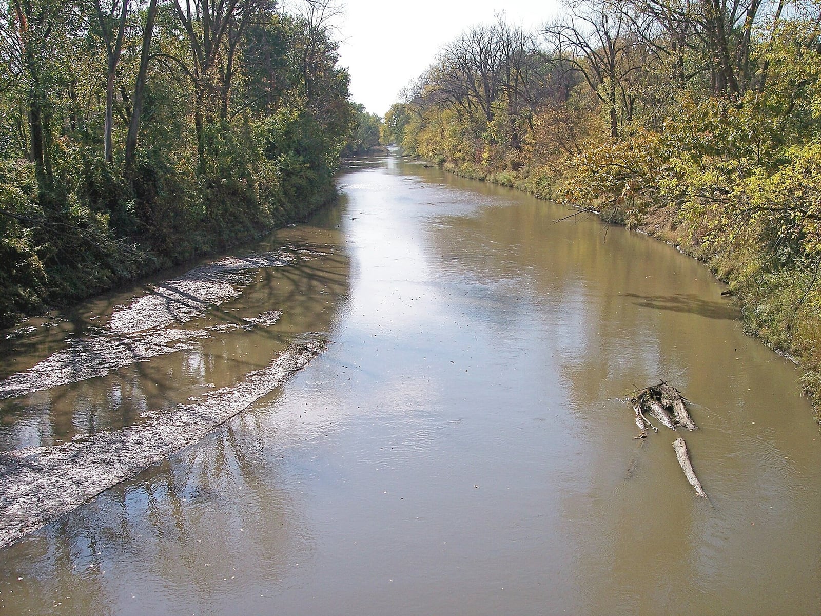
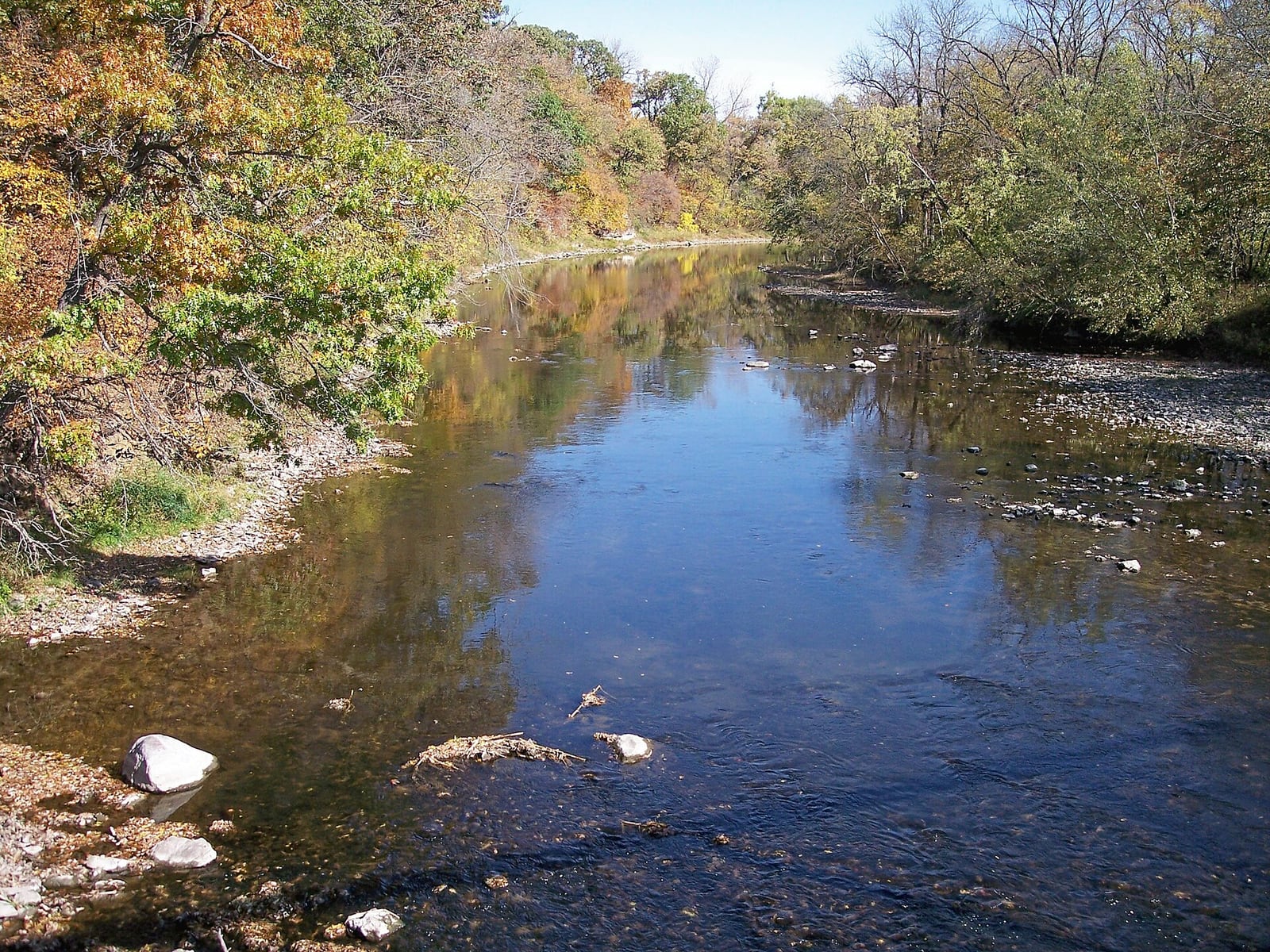
The Middle River runs between wooded banks with a low gravel bar and overhanging trees.
Iowa routeCentral IowaMiddle RiverMiddle River Forest Park to Schildberg AccessLaunch from Middle River Forest Park Access #89 and take out at Schildberg Access #78. This is the first developed Middle River Water Trail leg, with a...

Route facts

Moderate | About 11 mi | About 3 hr to 4 hr depending on level and scoutingofficial source support
Placeholder river image for Middle River - Pammel Park Ford Access to Holliwell Covered Bridge Access.
Iowa routeCentral IowaMiddle RiverPammel Park Ford Access to Holliwell Covered Bridge AccessShorter options: 4.0–9.0 miConsolidated Middle River route from Pammel Park to Holliwell Covered Bridge, with Middle River County Park retained as a public intermediate access, ca...

Route facts

Moderate | About 13 mi | About 5 to 7 hours for the full 13-mile route; Middle River County Park provides a shorter roughly 9-mile optionofficial source support
Placeholder river image for Middle River - Roseman Covered Bridge Access to Pammel Park Ford Access.
Iowa routeCentral IowaMiddle RiverRoseman Covered Bridge Access to Pammel Park Ford AccessLaunch from Roseman Covered Bridge and paddle the scenic limestone-bluff reach to Pammel Park, taking out river-left before the historic ford portage.

Route facts

Moderate | About 8.7 mi | About 2.5 hr to 4.5 hr, longer with low-water dragging or ford-portage scoutingofficial source support
The Middle River runs between wooded banks with a low gravel bar and overhanging trees.
Iowa routeCentral IowaMiddle RiverSchildberg Access to Roseman Covered Bridge AccessLaunch from Schildberg Access #78 and take out at Roseman Covered Bridge Access #71. This official Middle River Water Trail section is short enough for...

Route facts

Moderate | About 6.9 mi | About 1 hr 45 min to 3 hr 30 min depending on level and scoutingofficial source support

Iowa beginner routes

These routes are tagged easy in the route data. Today's water can still change the call.

Showing 8 of 52 beginner routes. Use the Easy difficulty filter below to see the full set.

Routes with practical logistics

Use the live weekend board for score-based recommendations.

Rivers and regions

Compact directory links for crawlers and planners.

By river

Cedar River20
Des Moines River16
North Raccoon River11
Maquoketa River9
Turkey River9
Wapsipinicon River8
Boone River6
North Fork Maquoketa River6
South Skunk River6
Upper Iowa River6
Iowa River4
Middle River4
Lizard Creek3
Middle Raccoon River3
Shell Rock River3
Volga River3
West Nishnabotna River3
Black Hawk Creek2
Yellow River2
East Nishnabotna River1
Little Sioux River1
Little Turkey River1
North Skunk River1
Raccoon River1
South Raccoon River1
Winnebago River1

By region

Cedar Rapids Area1
Cedar Valley7
Central Iowa24
Driftless Area1
Eastern Iowa11
Iowa City Area2
Iowa County1
North Central Iowa17
North Iowa4
North-Central Iowa9
Northeast Iowa35
Northwest Iowa6
Southeast Iowa9
Southwest Iowa4

Every Iowa route on Paddle Today

131 server-rendered route links.

Showing all 131 routes.

Black Hawk CreekFranck Park to Ranchero RoadCedar Valley | HardBlack Hawk CreekRanchero Road to Hope Martin ParkCedar Valley | HardBoone RiverAlbright's Canoe Access to Tunnel Mill Canoe AccessNorth Central Iowa | ModerateBoone RiverBell's Mill Park to Boone Forks Wildlife AreaNorth Central Iowa | EasyBoone RiverBriggs Woods Park to Albright's Canoe AccessNorth Central Iowa | ModerateBoone RiverRiverside Park Access to Albright's Canoe AccessNorth Central Iowa | ModerateBoone RiverRiverside Park Access to Briggs Woods ParkNorth Central Iowa | EasyBoone RiverTunnel Mill Canoe Access to Bell's Mill ParkNorth Central Iowa | EasyCedar RiverAcorn Park to Halvorson ParkNorth Central Iowa | ModerateCedar RiverBennett Access to Highway 9 BridgeNorth Central Iowa | ModerateCedar RiverBrookwood Park to Janesville City ParkCedar Valley | EasyCedar RiverCedar Bend Park to Three Rivers ParkCedar Valley | EasyCedar RiverChain Lakes / Palo to Ellis HarborCedar Rapids Area | ModerateCedar RiverCharles City Dock to Nashua AccessNorth Iowa | EasyCedar RiverCharles City Whitewater ParkNorth Central Iowa | HardCedar RiverHalvorson Park to Interstate Park / MitchellNorth Central Iowa | ModerateCedar RiverHighway 9 Bridge to Osage Spring ParkNorth Central Iowa | ModerateCedar RiverIdlewild Park Access to Rotary Park AccessNorth Central Iowa | EasyCedar RiverInterstate Park / Mitchell to Bennett AccessNorth Central Iowa | EasyCedar RiverKohlmann Park below-dam relaunch to Brookwood ParkCedar Valley | EasyCedar RiverNashua below-dam access to Pearl RockNorth Iowa | EasyCedar RiverNorth Cedar Park to Cedar Bend ParkCedar Valley | EasyCedar RiverOsage Spring Park to Road T38 AccessNorth Central Iowa | ModerateCedar RiverOtranto Park below dam to Acorn ParkNorth Central Iowa | HardCedar RiverPearl Rock to North Cedar ParkNorth Iowa | EasyCedar RiverRoad T38 Access to Idlewild Park AccessNorth Central Iowa | EasyCedar RiverRotary Park Access to Charles City DockNorth Central Iowa | EasyCedar RiverThree Rivers Park to Kohlmann Park portage take-outCedar Valley | EasyDes Moines RiverAustin Park to Keosauqua Boat RampSoutheast Iowa | EasyDes Moines RiverBentonsport Boat Ramp to Bonaparte Boat RampSoutheast Iowa | EasyDes Moines RiverBonaparte Boat Ramp to Des Moines River AccessSoutheast Iowa | ModerateDes Moines RiverDeception Hollow to Skillet Creek AccessNorth-Central Iowa | HardDes Moines RiverDeer Creek Access to Hydro-electric ParkNorth-Central Iowa | ModerateDes Moines RiverDes Moines River Access to Farmington AccessSoutheast Iowa | EasyDes Moines RiverDouds Access to Austin ParkSoutheast Iowa | ModerateDes Moines RiverEldon Ramp to Shidepoke Access / SelmaSoutheast Iowa | EasyDes Moines RiverHighway 30 Access to Sportsman RampCentral Iowa | EasyDes Moines RiverHydro-electric Park to South River District AccessNorth-Central Iowa | ModerateDes Moines RiverKeosauqua Boat Ramp to Bentonsport Boat RampSoutheast Iowa | EasyDes Moines RiverLehigh Access to Deception HollowNorth-Central Iowa | ModerateDes Moines RiverShidepoke Access / Selma to Douds AccessSoutheast Iowa | EasyDes Moines RiverSkillet Creek Access to North Fraser RampCentral Iowa | ModerateDes Moines RiverSouth Fraser Ramp to Waterworks Upstream Access / E-26Central Iowa | ModerateDes Moines RiverSouth River District Access to LehighNorth-Central Iowa | ModerateEast Nishnabotna RiverCoolbaugh Street / Red Oak to Essex Bridge AccessSouthwest Iowa | EasyIowa RiverHills Access to River Junction AccessIowa City Area | EasyIowa RiverMarengo to AmanaIowa County | ModerateIowa RiverSturgis Ferry Park to Hills AccessIowa City Area | EasyIowa RiverTailwater East below Coralville Dam to Sturgis Ferry ParkEastern Iowa | EasyLittle Sioux RiverLinn Grove Dam Area to Riverside Little Sioux AccessNorthwest Iowa | EasyLittle Turkey RiverGouldsburg Park to Eldorado Bridge AccessNortheast Iowa | ModerateLizard CreekCunningham Access to Rasch AccessNorth-Central Iowa | HardLizard CreekLentsch Access to Cunningham AccessNorth-Central Iowa | ModerateLizard CreekRasch Access to Phinney ParkNorth-Central Iowa | HardMaquoketa RiverBackbone Lake Dam Landing to Dundee AccessNortheast Iowa | ModerateMaquoketa RiverCanton Bridge Access to Royertown Bridge AccessNortheast Iowa | EasyMaquoketa RiverDundee Access to Manchester Whitewater ParkNortheast Iowa | ModerateMaquoketa RiverEby's Mill Access to Supples Bridge AccessEastern Iowa | EasyMaquoketa RiverManchester Whitewater ParkNortheast Iowa | ModerateMaquoketa RiverMillertown / Monmouth corridor to Bridgeport AccessEastern Iowa | EasyMaquoketa RiverMon-Maq Dam Access to Pictured Rocks ParkNortheast Iowa | EasyMaquoketa RiverPictured Rocks Park to Eby's Mill AccessNortheast Iowa | EasyMaquoketa RiverQuaker Mill Dam to Bailey's Ford AccessNortheast Iowa | ModerateMiddle Raccoon RiverCowles River Access to Redfield Dam Upper AccessCentral Iowa | ModerateMiddle Raccoon RiverLenon Mill Park Access to P-28 AccessCentral Iowa | ModerateMiddle Raccoon RiverP-28 Access to Cowles River AccessCentral Iowa | ModerateMiddle RiverMiddle River Forest Park to Schildberg AccessCentral Iowa | ModerateMiddle RiverPammel Park Ford Access to Holliwell Covered Bridge AccessCentral Iowa | ModerateMiddle RiverRoseman Covered Bridge Access to Pammel Park Ford AccessCentral Iowa | ModerateMiddle RiverSchildberg Access to Roseman Covered Bridge AccessCentral Iowa | ModerateNorth Fork Maquoketa RiverCascade Historic Limestone Silo to Caven Bridge AccessNortheast Iowa | HardNorth Fork Maquoketa RiverCascade Historic Limestone Silo to D61 AccessNortheast Iowa | ModerateNorth Fork Maquoketa RiverCascade Historic Limestone Silo to Ozark Bridge / 21st AveNortheast Iowa | HardNorth Fork Maquoketa RiverD61 Access / Whitewater Creek to Caven Bridge AccessNortheast Iowa | HardNorth Fork Maquoketa RiverD61 Access / Whitewater Creek to Ozark Bridge / 21st AveNortheast Iowa | HardNorth Fork Maquoketa RiverOzark Bridge / 21st Ave to Caven Bridge AccessNortheast Iowa | ModerateNorth Raccoon RiverEureka Bridge Access to Henderson Park AccessCentral Iowa | ModerateNorth Raccoon RiverGrant Park to Rainbow Bend AccessNorthwest Iowa | ModerateNorth Raccoon RiverHagge Park to White Horse AccessNorthwest Iowa | HardNorth Raccoon RiverHenderson Park Access to Squirrel Hollow ParkCentral Iowa | ModerateNorth Raccoon RiverHyde Park Access to McMahon AccessCentral Iowa | ModerateNorth Raccoon RiverRainbow Bend Access to Richey AccessCentral Iowa | ModerateNorth Raccoon RiverRichey Access to Hyde Park AccessCentral Iowa | EasyNorth Raccoon RiverRiverview / Sac City Access to Hagge ParkNorthwest Iowa | HardNorth Raccoon RiverSquirrel Hollow Park to Adkins Bridge AccessCentral Iowa | EasyNorth Raccoon RiverVogel Access to Riverview AccessNorthwest Iowa | ModerateNorth Raccoon RiverWhite Horse Access to Grant ParkNorthwest Iowa | HardNorth Skunk RiverDelta to Sigourney / South Skunk River AccessSoutheast Iowa | EasyRaccoon RiverVan Meter Access to Walnut Woods State ParkCentral Iowa | ModerateShell Rock RiverHeery Woods State Park to Renning's LandingNortheast Iowa | EasyShell Rock RiverRenning's Landing to Shell Rock Recreation AreaNortheast Iowa | EasyShell Rock RiverStrand Park to Wilkinson Pioneer ParkNorth-Central Iowa | EasySouth Raccoon RiverSouth Raccoon River Access to Van Meter AccessCentral Iowa | ModerateSouth Skunk RiverAmes 13th Street Play FeatureCentral Iowa | ModerateSouth Skunk RiverLekwa Access to Soper's MillCentral Iowa | ModerateSouth Skunk RiverPeterson Park West to Sleepy HollowCentral Iowa | ModerateSouth Skunk RiverRiver Valley Park to C.J. Shreck AccessCentral Iowa | ModerateSouth Skunk RiverSleepy Hollow to River Valley ParkCentral Iowa | ModerateSouth Skunk RiverSoper's Mill to Peterson Park WestCentral Iowa | ModerateTurkey RiverBig Spring Campground to Elkader AccessNortheast Iowa | EasyTurkey RiverClermont Canoe Access to Gilbertson Park / ElginNortheast Iowa | ModerateTurkey RiverElkader Whitewater Park to Garber AccessNortheast Iowa | ModerateTurkey RiverElkader Whitewater Park to Motor Mill AccessNortheast Iowa | ModerateTurkey RiverGarber Access to Millville AccessNortheast Iowa | ModerateTurkey RiverGilbertson Park / Elgin to Big Spring CampgroundNortheast Iowa | EasyTurkey RiverGilbertson Park / Elgin to Elkader AccessNortheast Iowa | ModerateTurkey RiverMillville Access to Ferry Landing Canoe TakeoutNortheast Iowa | ModerateTurkey RiverMotor Mill Access to Garber AccessNortheast Iowa | ModerateUpper Iowa RiverCattle Creek Road to Malanaphy SpringsNortheast Iowa | ModerateUpper Iowa RiverIverson Bridge Access to Kumpf AccessNortheast Iowa | EasyUpper Iowa RiverKendallville Park to Bluffton Fir Stand AccessNortheast Iowa | ModerateUpper Iowa RiverLower Dam Access to Iverson Bridge AccessDriftless Area | ModerateUpper Iowa RiverMalanaphy Springs to Trout Run ParkNortheast Iowa | EasyUpper Iowa RiverTrout Run Park to Lower DamNortheast Iowa | EasyVolga RiverKlock's Island Park to Heron Road AccessNortheast Iowa | ModerateVolga RiverMederville Canoe Access to Littleport Canoe AccessNortheast Iowa | EasyVolga RiverOsborne Canoe Access to Mederville Canoe AccessNortheast Iowa | EasyWapsipinicon RiverAllen's Grove Access to Gambril AccessEastern Iowa | ModerateWapsipinicon RiverKnott's Landing / Three Elms to Quasqueton CampgroundEastern Iowa | ModerateWapsipinicon RiverNewport Mills Access to Oxford Mills AccessEastern Iowa | EasyWapsipinicon RiverOxford Mills Access to Syracuse AccessEastern Iowa | ModerateWapsipinicon RiverSherman Park to Allen's Grove AccessEastern Iowa | ModerateWapsipinicon RiverStone City Access to Anamosa Boat Ramp above the damEastern Iowa | EasyWapsipinicon RiverSyracuse Access to Sherman ParkEastern Iowa | ModerateWapsipinicon RiverWapsipinicon State Park to Newport MillsEastern Iowa | EasyWest Nishnabotna RiverBotna Bend Park / Hancock to Chautauqua Park / OaklandSouthwest Iowa | EasyWest Nishnabotna RiverChautauqua Park / Oakland to Olde Town Park / MacedoniaSouthwest Iowa | EasyWest Nishnabotna RiverEdgington Memorial Park / Avoca to Botna Bend Park / HancockSouthwest Iowa | EasyWinnebago RiverFertile to Mason CityNorth Iowa | EasyYellow RiverBridge Sixteen to Highway 76Northeast Iowa | ModerateYellow RiverVolney Canoe Access to Sixteen BridgeNortheast Iowa | Moderate

Iowa paddling FAQ

How does Paddle Today choose Iowa paddle routes?

Paddle Today lists Iowa routes when the route has enough defensible gauge, threshold, source, and logistics support to make a live route score useful. The current Iowa page includes 131 tracked routes across 26 rivers.

Are these Iowa river conditions live?

The route links on this page are server-rendered and crawlable. Each route page then checks live gauge readings, weather, water-level context, and route score data before you make a same-day call.

Can I request another Iowa route?

Yes. Use the request form to send the river, reach, access points, and any source links. Paddle Today prioritizes routes where a public gauge or defensible threshold support can back the live score.