
See all 3 routes on Mohawk River
New York | Schenectady County / Rotterdam Junction and Glenville
Mohawk River
Lock 9 State Canal Park to Freeman's Bridge public launch
Check current paddling conditions for this Mohawk River route, including water level, recent gauge trend, weather, and route details.
Route location
Loading the route snapshot. This usually takes a few seconds.
Need to know
Why this call
Conditions
Gauge history and hourly forecast
The top card is the quick read. This lower section keeps the longer gauge trend, gauge context, and hourly forecast together.
Gauge detail
Gauge history & hourly forecastDetailed view
Gauge
Recent trend
Checking preferred range.
Checking trend.
Gauge source
--Checking timestampMN DNR provides the current paddling level here, but not chart-ready recent samples.
Weather
Hourly forecast
Checking weather.
Loading today's forecast.
Next 8 hours
Short-route forecast
Checking the next several hours.
Route overview
Quick facts and what's next
Distance, difficulty, shuttle basics, and the near-term outlook before you commit to the drive.
Quick facts
Plan ahead
Upcoming outlook
These are early planning reads. Re-check live conditions before you commit to the drive.
Waiting on forecast.
Waiting on forecast.
Plan
Plan your trip
Launch points, shuttle details, distance, and access notes.
Route logistics
Access and shuttle
A planning-only approximately nine-mile Mohawk River/Erie Canalway section from the public Lock 9 State Canal Park hand launch to the public Freeman's Bridge launch. The Erie Canalway stewardship inventory names this launch-to-launch segment and its intermediate access sequence; NYSDEC independently lists both endpoint access areas. The route is bounded to the named launches and does not authorize entering lock chambers, approaching spillways, or improvising a portage on private or canal infrastructure.
Prepare this trip
Take the plan with you
Download the canonical route, add a calendar hold, or send a simple float plan to your group.
Put-in
Lock 9 State Canal Park public hand launch, Rotterdam JunctionNYSDEC launch listings establish public endpoint areas, not a right to land at every lock, bridge, marina, or bank along the corridor.
Take-out
Freeman's Bridge public Mohawk River launch, GlenvilleThe water-trail inventory includes intermediate access context, but private marinas and workboat facilities are not substitute public bailouts unless current permission is confirmed.
Plan this segment
Pulling access map tiles. Usually under 5 seconds.
Access caveats and watch for
Access caveats
- NYSDEC launch listings establish public endpoint areas, not a right to land at every lock, bridge, marina, or bank along the corridor.
- The water-trail inventory includes intermediate access context, but private marinas and workboat facilities are not substitute public bailouts unless current permission is confirmed.
- The route ends at Freeman's Bridge. The downstream Lock 7/Waterford direction requires a separate section review and must not be improvised from this card.
Watch for
- USGS 01354330 stage changes, Lock 8 regulation, canal closure or navigation notices, spillway/guard-gate activity, and fast local rise
- workboats, barges, wakes, bridges, strainers, floating debris, cold water, wind, and urban water-quality advisories
- Lock 9 and Freeman's Bridge parking, carry, water entry, landing, private-bank signs, and daylight for the shuttle
Route gallery
See this route on the water
Photos help show what the access looks like and what the route actually feels like on the water.
Score & sources
Why this score
See the gauge, weather, and source notes behind today's call.
Why this scoreToday's evidence strength is checking
Evidence strength mostly comes down to three things: how direct the active gauge is, how clear the range is, and how fresh the data is.
- Checking evidence-strength notes.
- Checking evidence cautions.
Data behind the scoreGauge, thresholds, and timing
These are the live readings and threshold notes behind today's score.
| Gauge site | Mohawk River at Lock 8 near Schenectady, NY |
| Gauge height | Checking |
| Discharge | Checking |
| 24h trend | Checking |
| 24h change | Checking |
| Current band | Checking |
| Rain last 24h | Checking |
| Rain last 72h | Checking |
| Air temp | Checking |
| Water temp | Checking |
| Wind | Checking |
| Gusts | Checking |
| Rain timing | Checking |
| Ideal range | Needs paddler reports |
| Known low-water floor | Not calibrated yet |
| High threshold | Not calibrated yet |
| Evidence strength behind the range | Official and local sources |
| Gauge observed | Checking |
| Paddle Today updated | Checking |
| Main source behind this score | No universal runnable cutoff is published for this lock-controlled section; use the active Lock 8 stage record, canal navigation status, recent weather, debris, and a local inspection |
| Gauge source | Checking |
| Weather source | Checking |
| Rainfall source | Checking |
NotesWhat to know before you go
These notes cover the access details, route quirks, and source caveats most likely to matter once you get there.
- Current public endpoint chainLock 9 State Canal Park to Freeman's Bridge public launches
NYSDEC lists both endpoint access areas as public Mohawk River/Barge Canal launches with current parking and launch-type context.
- Named water-trail segmentLock E9, Rotterdam Junction to Freeman's Bridge; approximately 9 miles
The Erie Canalway stewardship inventory names this launch sequence, segment length, and downstream Freeman's Bridge ramp.
- Direct live gaugeUSGS 01354330 Mohawk River at Lock 8 near Schenectady
The active station is within the corridor and records stage, but the station notes considerable regulation by Lock 8 and Vischer Ferry; use it as context, not a universal threshold.
- Route-specific navigation safetyLock, spillway, workboat, barge, bridge, wake, debris, and regulated-stage controls
The Canalway water-trail guide and USGS station notes identify strong-current, workboat, lock, and regulation hazards that must be checked locally.
- Camping postureNearby managed basecamp only; no launch-site or riverbank camping claim
Use separately verified lodging or campground facilities and follow Canal Corporation, municipal, and landowner rules.
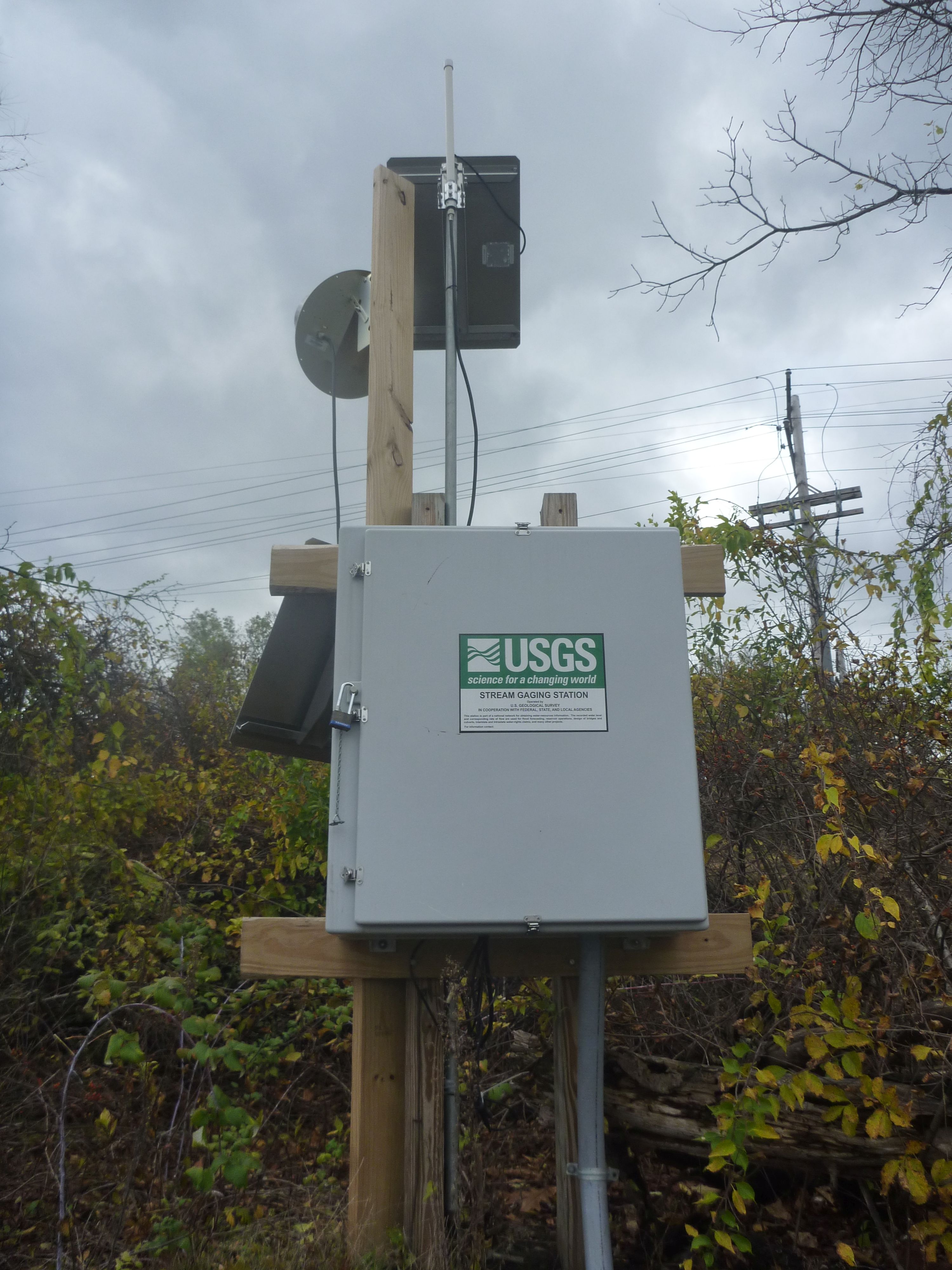
- Approved same-river imageUSGS Lock 8 station photograph used as direct Mohawk River context
The public-domain image is labeled as same-river station context and does not certify current lock, traffic, debris, water-quality, or endpoint conditions.
- Direct live gaugeUSGS 01354330, Mohawk River at Lock 8 near Schenectady, NY
USGS 01354330 at Lock 8 is an active direct stage station within this corridor. Its record warns that Lock 8 and the downstream Vischer Ferry hydro facility regulate stage; it cannot certify lock operations, local debris, boat traffic, water quality, or endpoint access.
- Safety and river conditionsCheck live gauge, recent rainfall, trend, debris, bridges, and access conditions before launch
NYSDEC / Erie Canalway / USGS and its linked safety material warn that conditions change rapidly and require local inspection.
- Image decisionApproved same-river context image used for route presentation
The image is labeled as river-level context when it depicts the named river elsewhere, not this exact reach.
Verify it yourselfCheck the source links
Use these links to double-check the gauge, route details, and access notes before you head out.
Paddler reports
Recent notes from paddlers
A few quick notes from people who were on this route recently.
Reports
Paddler reports
See recent photos and notes from people on the route.
Share your trip
Keep exploring
More routes to check next
Compare another stretch on this river, or jump to nearby options before you pick a plan.
More in New York
All 296 routesMore on Mohawk River
All 3Nearby routes by distance
Quick answers
Mohawk River paddling FAQ
What water level is good for paddling Mohawk River?
Paddle Today watches Mohawk River at Lock 8 near Schenectady, NY and uses Not calibrated yet as the conservative low-water floor for this route. The ideal range still needs more paddler reports.
Where does this Mohawk River route start and end?
This route starts at Lock 9 State Canal Park public hand launch, Rotterdam Junction and ends at Freeman's Bridge public Mohawk River launch, Glenville, about Approximately 9 water-trail miles from Lock E9 to Freeman's Bridge on the water.
Is this Mohawk River route good for beginners?
This is listed as a moderate route. Expect more planning than an easy float, and use the live score, route notes, and source links before committing.
Flag a change
See something outdated?
Access, hazards, wood, and shuttle details change. Send a quick correction if something looks off.