
See all 2 routes on Esopus Creek
New York | Ulster County / Catskill Park
Esopus Creek
Mt. Tremper–Phoenicia Road DEC access to Boiceville Supermarket pullout
Check current paddling conditions for this Esopus Creek route, including water level, recent gauge trend, weather, and route details.
Route location
Loading the route snapshot. This usually takes a few seconds.
Need to know
Why this call
Conditions
Gauge history and hourly forecast
The top card is the quick read. This lower section keeps the longer gauge trend, gauge context, and hourly forecast together.
Gauge detail
Gauge history & hourly forecastDetailed view
Gauge
Recent trend
Checking preferred range.
Checking trend.
Gauge source
--Checking timestampMN DNR provides the current paddling level here, but not chart-ready recent samples.
Weather
Hourly forecast
Checking weather.
Loading today's forecast.
Next 8 hours
Short-route forecast
Checking the next several hours.
Route overview
Quick facts and what's next
Distance, difficulty, shuttle basics, and the near-term outlook before you commit to the drive.
Quick facts
Plan ahead
Upcoming outlook
These are early planning reads. Re-check live conditions before you commit to the drive.
Waiting on forecast.
Waiting on forecast.
Plan
Plan your trip
Launch points, shuttle details, distance, and access notes.
Route logistics
Access and shuttle
A distinct approximately 6.3-mile upper Esopus Creek Class II+ reach from the public DEC fishing-access area on Mt. Tremper–Phoenicia Road to the Boiceville pullout above the Route 28A bridge. American Whitewater identifies the access pair, Sleepy Hollow rapid, strainers, reservoir boundary, and Coldbrook gauge; DEC adds cold-water and moving-water safety context. It is separate from the existing Mount Marion–Saugerties lower Esopus card.
Prepare this trip
Take the plan with you
Download the canonical route, add a calendar hold, or send a simple float plan to your group.
Put-in
Mt. Tremper–Phoenicia Road DEC fishing-access areaAmerican Whitewater describes two public DEC fishing-access locations on Mt. Tremper–Phoenicia Road, but a fishing-access description is not a guarantee of a maintained kayak ramp or unrestricted group staging. Verify current water entry and parking.
Take-out
Boiceville Supermarket Esopus Creek pullout above Route 28A bridgeThe Boiceville Supermarket pullout is described by the route source, not listed here as a DEC boat launch. Obtain current permission for the pullout and use Onteora Central School parking only where and when permitted; never block business, school, road, or bridge access.
Plan this segment
Pulling access map tiles. Usually under 5 seconds.
Access caveats and watch for
Access caveats
- American Whitewater describes two public DEC fishing-access locations on Mt. Tremper–Phoenicia Road, but a fishing-access description is not a guarantee of a maintained kayak ramp or unrestricted group staging. Verify current water entry and parking.
- The Boiceville Supermarket pullout is described by the route source, not listed here as a DEC boat launch. Obtain current permission for the pullout and use Onteora Central School parking only where and when permitted; never block business, school, road, or bridge access.
- This card is distinct from the existing Mount Marion–Saugerties lower Esopus reach and ends above the Ashokan Reservoir slackwater. Do not merge the cards or infer a continuous public access chain between them.
- DEC’s Ulster County directory includes lower Esopus launches and nearby Upper Pond access, but those locations are not substituted into this upper route without a new route-shape and access review.
Watch for
- USGS 01362500 unavailable, rapidly rising, unusually low, or inconsistent with the local channel and current release conditions
- Sleepy Hollow rapid, river-wide or bank strainers, shallow rocks, bridge hydraulics, flood debris, cold water, and limited bailout options
- DEC access-area parking and carry, Boiceville pullout permission, supermarket/school traffic, private banks, daylight, and the Ashokan Reservoir boundary
Route gallery
See this route on the water
Photos help show what the access looks like and what the route actually feels like on the water.
Score & sources
Why this score
See the gauge, weather, and source notes behind today's call.
Why this scoreToday's evidence strength is checking
Evidence strength mostly comes down to three things: how direct the active gauge is, how clear the range is, and how fresh the data is.
- Checking evidence-strength notes.
- Checking evidence cautions.
Data behind the scoreGauge, thresholds, and timing
These are the live readings and threshold notes behind today's score.
| Gauge site | Esopus Creek at Coldbrook, NY |
| Discharge | Checking |
| Gauge height | Checking |
| 24h trend | Checking |
| 24h change | Checking |
| Current band | Checking |
| Rain last 24h | Checking |
| Rain last 72h | Checking |
| Air temp | Checking |
| Water temp | Checking |
| Wind | Checking |
| Gusts | Checking |
| Rain timing | Checking |
| Ideal range | Needs paddler reports |
| Known low-water floor | Not calibrated yet |
| High threshold | Not calibrated yet |
| Evidence strength behind the range | Official and local sources |
| Gauge observed | Checking |
| Paddle Today updated | Checking |
| Main source behind this score | Route-specific reports discuss approximately 400 cfs as a lower reference on the upstream Allaben gauge, but no defensible numeric cutoff is asserted for direct Coldbrook use |
| Gauge source | Checking |
| Weather source | Checking |
| Rainfall source | Checking |
NotesWhat to know before you go
These notes cover the access details, route quirks, and source caveats most likely to matter once you get there.
- Distinct upper Esopus corridorPhoenicia to Boiceville; approximately 6.3 miles; Class II+
American Whitewater publishes the matching endpoint pair, route length, class, easier downstream character, Sleepy Hollow rapid, and reservoir boundary.
- Public upstream accessMt. Tremper–Phoenicia Road DEC fishing-access locations
American Whitewater identifies two public DEC fishing-access points, including the route start southeast of Rawson Road; confirm current carry and water entry.
- Downstream pullout contextBoiceville Supermarket pullout before Route 28A bridge
The route source describes the take-out and advises using Onteora Central School parking when the market is busy. Treat both as permission-sensitive access-area logistics.
- Direct live gaugeUSGS 01362500 Esopus Creek at Coldbrook, NY
USGS provides continuous and daily direct Esopus Creek stage and discharge records at Coldbrook, approximately 1.5 miles upstream of Ashokan Reservoir.
- Route-specific flow contextHistorical reports discuss approximately 400 cfs as an upstream lower reference, not a Coldbrook cutoff
American Whitewater trip reporting distinguishes the upstream Allaben reference from higher Coldbrook readings and describes the reach as fast and pushy at higher flow; no numeric threshold is asserted here.
- Safety guidanceCold-water, swift-current, debris, and release checks
NYSDEC’s paddling guidance emphasizes PFD use and the consequences of cold water, swift current, rocks, logs, and other objects; Esopus releases are separately managed for recreation.
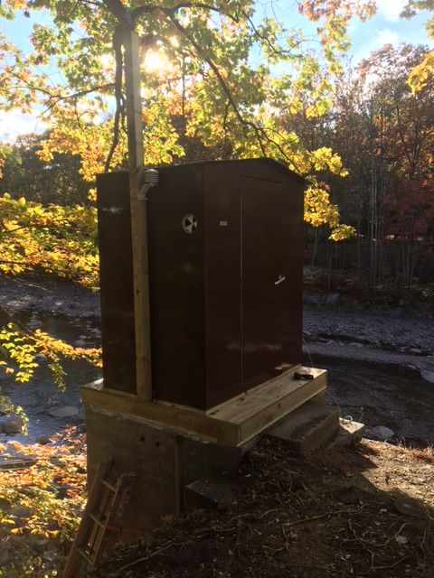
- Approved same-river imageUSGS Esopus Creek at Coldbrook station context image
The station photograph is labeled as same-river context and does not certify the exact route, current release, wood, or landing.
- Nearby campingSleepy Hollow and Phoenicia Black Bear campground context
Both are nearby or directly on the Esopus corridor; reserve separately and do not infer permission to land or camp at the river access.
- Direct live gaugeUSGS 01362500, Esopus Creek at Coldbrook, NY
USGS 01362500 is a direct Esopus Creek discharge and stage station at Coldbrook, with continuous and daily records current through 2026. It is strong route context but does not certify the DEC access, local wood, release timing, or Boiceville pullout; pair it with current rain, trend, release, and visual checks.
- Safety and river conditionsCheck live gauge, recent rainfall, trend, debris, bridges, and access conditions before launch
American Whitewater / NYSDEC / USGS Esopus Creek sources and its linked safety material warn that conditions change rapidly and require local inspection.
- Image decisionApproved same-river context image used for route presentation
The image is labeled as river-level context when it depicts the named river elsewhere, not this exact reach.
Verify it yourselfCheck the source links
Use these links to double-check the gauge, route details, and access notes before you head out.
- American Whitewater / NYSDEC / USGS Esopus Creek sources route record
- American Whitewater Esopus access records and NYSDEC Ulster County launch directory
- American Whitewater Phoenicia to Boiceville route and current-condition notes
- NYSDEC paddling, cold-water, and water-release safety guidance
- USGS 01362500 monitoring location
- USGS 01362500 current conditions
- Esopus Creek context image
Paddler reports
Recent notes from paddlers
A few quick notes from people who were on this route recently.
Reports
Paddler reports
See recent photos and notes from people on the route.
Share your trip
Keep exploring
More routes to check next
Compare another stretch on this river, or jump to nearby options before you pick a plan.
More in New York
All 296 routesMore on Esopus Creek
All 2Nearby routes by distance
Quick answers
Esopus Creek paddling FAQ
What water level is good for paddling Esopus Creek?
Paddle Today watches Esopus Creek at Coldbrook, NY and uses Not calibrated yet as the conservative low-water floor for this route. The ideal range still needs more paddler reports.
Where does this Esopus Creek route start and end?
This route starts at Mt. Tremper–Phoenicia Road DEC fishing-access area and ends at Boiceville Supermarket Esopus Creek pullout above Route 28A bridge, about Approximately 6.3 river miles from the Mt. Tremper–Phoenicia Road DEC fishing-access area to the Boiceville pullout above the Route 28A bridge on the water.
Is this Esopus Creek route good for beginners?
This is listed as a moderate route. Expect more planning than an easy float, and use the live score, route notes, and source links before committing.
Flag a change
See something outdated?
Access, hazards, wood, and shuttle details change. Send a quick correction if something looks off.