State routes

Alabama Rivers

Compare 50 tracked Alabama paddle routes with route links, water-level context, difficulty, and access planning details.

41 routes support live scores. 9 planning-only routes provide trip details and source links without a live route score.

50 routes11 rivers15 regions13 beginner routes
Skip map

Loading supported rivers and route reaches.

End of map

Explore supported Alabama rivers

Scan the highlighted river network from above, then use the route guides and access markers to find a supported reach.

50 route markers11 multi-route rivers13 beginner routes
Supported riverSelected reachAccess-point connectionStrong conditionsGood conditionsWatch closelySkip

Best Alabama routes today

Loading current scores, gauge reads, and weather signals.

--Live
Mobile-Tensaw Delta / Baldwin County Forever Wild lands

Bartram Canoe Trail

Canal Island / Dead Lake route: French's Lake Coastal Access Kiosk (water-entry edge) to Upper Bryant Landing public-use access (water-entry edge)

Moderate | About 11 river miles | Plan 3 days / 2 nights with confirmed platform reservations and full shuttle margin | Live score supported
View trip details
--Live
Mobile-Tensaw Delta / Baldwin County Forever Wild lands

Bartram Canoe Trail

Dead Lake overnight route: Upper Bryant Landing public-use access (water-entry edge) to Upper Bryant Landing public-use access (water-entry edge)

Moderate | About 7 river miles | Plan 2 days / 1 night with wind and campsite reservation margin | Live score supported
View trip details
--Live
Mobile-Tensaw Delta / Baldwin County Forever Wild lands

Bartram Canoe Trail

Douglas Lake Trail: Upper Bryant Landing public-use access (water-entry edge) to Upper Bryant Landing public-use access (water-entry edge)

Moderate | About 10.2 river miles | Allow 5–8 hours with open-water wind and navigation margin | Live score supported
View trip details
--Live
Mobile-Tensaw Delta / Baldwin County Forever Wild lands

Bartram Canoe Trail

Fisher Island Trail: Rice Creek Landing public access (water-entry edge) to Rice Creek Landing public access (water-entry edge)

Moderate | About 8.9 river miles | Allow 4–7 hours with navigation and open-water margin | Live score supported
View trip details

Current scores load here when available. You can still open the route links to check details and sources if this update fails.

Good starting points in Alabama

Ranked from route metadata, source support, difficulty, and logistics.
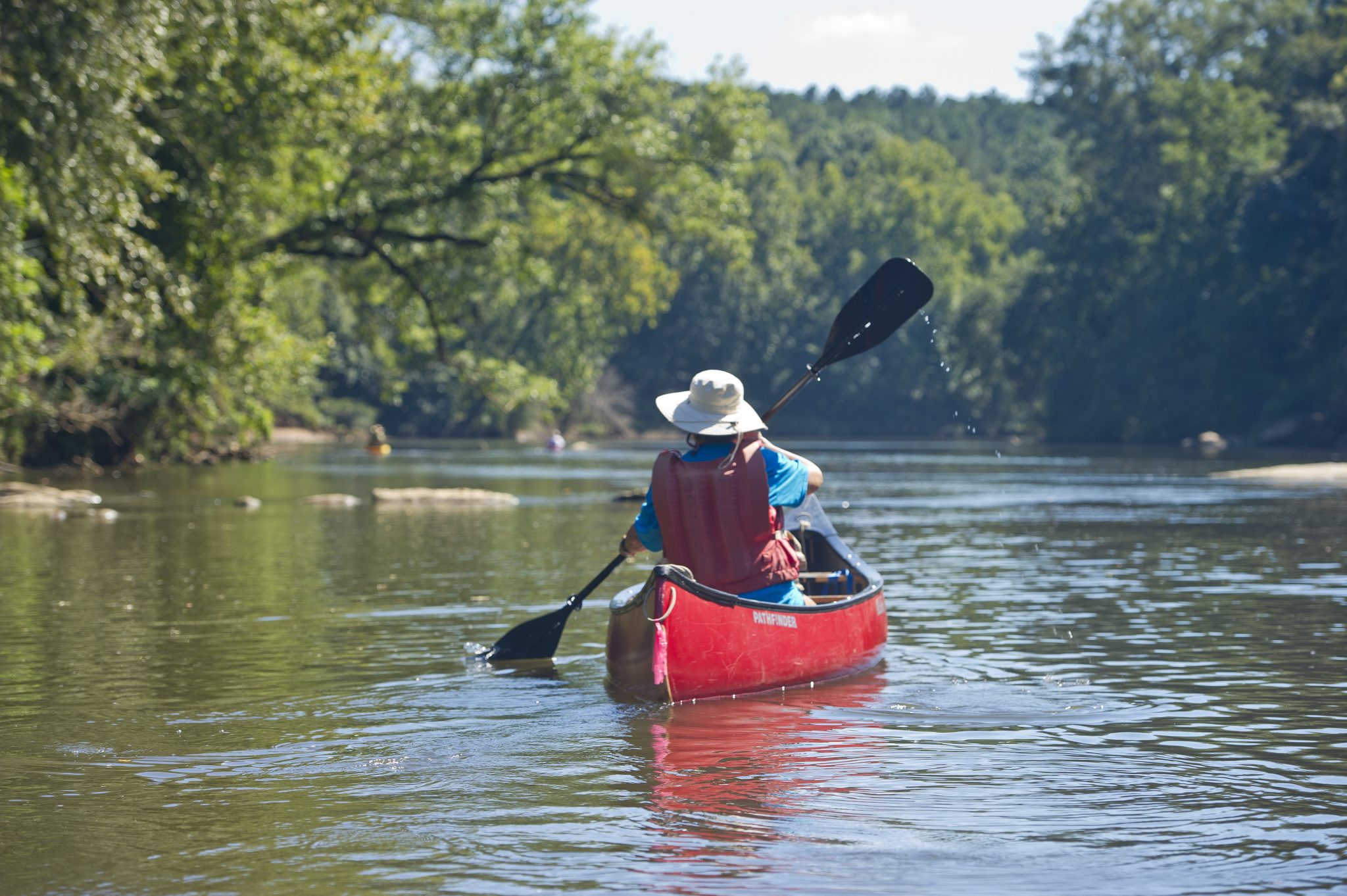
A canoeist paddles the Harold Banks Canoe Trail on Alabama’s Tallapoosa River.
Alabama routeTallapoosa / Chambers CountiesTallapoosa RiverBibby's Ferry to Germany's FerryThe upper Harold Banks Canoe Trail section from Bibby's Ferry through the Fish Trap and brisk shoals to Germany's Ferry Bridge.

Route facts

Easy | About 8.25 river miles | Allow about 5 hours plus shuttle and scouting time | Live score supportedofficial source support
A canoeist paddles the Harold Banks Canoe Trail on Alabama’s Tallapoosa River.
Alabama routeTallapoosa / Chambers CountiesTallapoosa RiverBibby's Ferry to Horseshoe BendA combined upper and middle Harold Banks itinerary from Bibby's Ferry through Germany's Ferry and Griffin Shoals to Horseshoe Bend.

Route facts

Easy | About 18 river miles | Plan a long day with an early start, scouting and shuttle margin | Live score supportedofficial source support
A canoeist paddles the Harold Banks Canoe Trail on Alabama’s Tallapoosa River.
Alabama routeTallapoosa / Chambers CountiesTallapoosa RiverBibby's Ferry to Jay Bird CreekThe full Harold Banks Canoe Trail itinerary across the documented 25-mile Tallapoosa corridor from Bibby's Ferry to Jay Bird Creek.

Route facts

Easy | About 24 river miles | Plan a full-day or permitted overnight expedition with substantial shuttle margin | Live score supportedofficial source support
A canoeist paddles the Harold Banks Canoe Trail on Alabama’s Tallapoosa River.
Alabama routeTallapoosa / Chambers CountiesTallapoosa RiverGermany's Ferry to Horseshoe BendThe middle Harold Banks section from Germany's Ferry through Griffin Shoals to Horseshoe Bend National Military Park.

Route facts

Easy | About 9.75 river miles | Allow about 6 hours plus shuttle and scouting time | Live score supportedofficial source support
A canoeist paddles the Harold Banks Canoe Trail on Alabama’s Tallapoosa River.
Alabama routeTallapoosa / Chambers CountiesTallapoosa RiverGermany's Ferry to Jay Bird CreekA combined middle and lower Harold Banks itinerary from Germany's Ferry through Horseshoe Bend and Peters Island to Jay Bird Creek.

Route facts

Easy | About 15.75 river miles | Plan a long day with shoal scouting and shuttle margin | Live score supportedofficial source support
A canoeist paddles the Harold Banks Canoe Trail on Alabama’s Tallapoosa River.
Alabama routeTallapoosa / Chambers CountiesTallapoosa RiverHorseshoe Bend to Jay Bird CreekThe most popular and scenic lower Harold Banks section from Horseshoe Bend past Peters Island, shoal lilies and side chutes to Jay Bird Creek.

Route facts

Easy | About 6 river miles | Allow about 4 hours plus shuttle and scouting time | Live score supportedofficial source support

Alabama beginner routes

These routes are tagged easy in the route data. Today's water can still change the call.

Showing 8 of 13 beginner routes. Use the Easy difficulty filter below to see the full set.

Routes with practical logistics

Use the live weekend board for score-based recommendations.

Rivers and regions

Expand a river or region to browse its routes.

By river

Bartram Canoe Trail13
Tallapoosa River7
Locust Fork5
Flint River4
Terrapin Creek4
Autauga Creek Canoe Trail3
Cahaba River3
Coosa River3
Hatchet Creek3
Mulberry Fork3
Sipsey Fork2

By region

Autauga County / Prattville1
Bankhead National Forest / Winston County2
Birmingham / Upper Cahaba Blueway3
Blount County5
Blount County / Garden City3
Calhoun County / Piedmont2
Cherokee County / Ellisville1
Cleburne County / Borden Springs1
Coosa County / Central Alabama3
Madison County / Huntsville4
Mobile-Tensaw Delta / Baldwin County Forever Wild lands13
Prattville / Alabama River1
Prattville / Autauga County1
Tallapoosa / Chambers Counties7
Wetumpka / Jordan Dam tailwater3

Every Alabama route on Paddle Today

50 routes with condition and access details.

Showing all 50 routes.

Autauga Creek / Alabama River connectorPrattville City Hall to Cooters Pond ParkPrattville / Alabama River | Moderate | Planning only · no live scoreAutauga Creek Canoe TrailBridge Creek / County Road 10 to Prattville City Hall portageAutauga County / Prattville | Moderate | Planning only · no live scoreAutauga Creek Canoe TrailPrattville City Hall to Autauga Creek Canoe Trail ParkPrattville / Autauga County | Moderate | Planning only · no live scoreBartram Canoe TrailCanal Island / Dead Lake route: French's Lake Coastal Access Kiosk (water-entry edge) to Upper Bryant Landing public-use access (water-entry edge)Mobile-Tensaw Delta / Baldwin County Forever Wild lands | Moderate | Live score supportedBartram Canoe TrailCanal Island overnight route: French's Lake Coastal Access Kiosk (water-entry edge) to Hubbard Landing public access (water-entry edge)Mobile-Tensaw Delta / Baldwin County Forever Wild lands | Moderate | Planning only · no live scoreBartram Canoe TrailDead Lake overnight route: Upper Bryant Landing public-use access (water-entry edge) to Upper Bryant Landing public-use access (water-entry edge)Mobile-Tensaw Delta / Baldwin County Forever Wild lands | Moderate | Live score supportedBartram Canoe TrailDouglas Lake Trail: Upper Bryant Landing public-use access (water-entry edge) to Upper Bryant Landing public-use access (water-entry edge)Mobile-Tensaw Delta / Baldwin County Forever Wild lands | Moderate | Live score supportedBartram Canoe TrailFisher Island Trail: Rice Creek Landing public access (water-entry edge) to Rice Creek Landing public access (water-entry edge)Mobile-Tensaw Delta / Baldwin County Forever Wild lands | Moderate | Live score supportedBartram Canoe TrailGlobe Creek Trail: French's Lake Coastal Access Kiosk (water-entry edge) to Hubbard Landing public access (water-entry edge)Mobile-Tensaw Delta / Baldwin County Forever Wild lands | Moderate | Live score supportedBartram Canoe TrailIndian Mound Trail: Rice Creek Landing public access (water-entry edge) to Rice Creek Landing public access (water-entry edge)Mobile-Tensaw Delta / Baldwin County Forever Wild lands | Moderate | Live score supportedBartram Canoe TrailJug Lake overnight route: Rice Creek Landing public access (water-entry edge) to Rice Creek Landing public access (water-entry edge)Mobile-Tensaw Delta / Baldwin County Forever Wild lands | Moderate | Live score supportedBartram Canoe TrailRed Hill / Proctor Creek Trail: Hubbard Landing public access (water-entry edge) to Hubbard Landing public access (water-entry edge)Mobile-Tensaw Delta / Baldwin County Forever Wild lands | Moderate | Live score supportedBartram Canoe TrailRichardson Island Trail: Rice Creek Landing public access (water-entry edge) to Rice Creek Landing public access (water-entry edge)Mobile-Tensaw Delta / Baldwin County Forever Wild lands | Moderate | Live score supportedBartram Canoe TrailSpoonbill Sandbar / Two Rivers Point route: French's Lake Coastal Access Kiosk (water-entry edge) to Rice Creek Landing public access (water-entry edge)Mobile-Tensaw Delta / Baldwin County Forever Wild lands | Moderate | Live score supportedBartram Canoe TrailSpoonbill Sandbar overnight route: French's Lake Coastal Access Kiosk (water-entry edge) to Hubbard Landing public access (water-entry edge)Mobile-Tensaw Delta / Baldwin County Forever Wild lands | Moderate | Planning only · no live scoreBartram Canoe TrailTwo Rivers Point overnight route: Rice Creek Landing public access (water-entry edge) to Rice Creek Landing public access (water-entry edge)Mobile-Tensaw Delta / Baldwin County Forever Wild lands | Moderate | Live score supportedCahaba RiverGrants Mill access to Old Overton Road accessBirmingham / Upper Cahaba Blueway | Moderate | Planning only · no live scoreCahaba RiverMoon River access to Grants Mill accessBirmingham / Upper Cahaba Blueway | Moderate | Live score supportedCahaba RiverOld Overton Road access to US Highway 280 accessBirmingham / Upper Cahaba Blueway | Moderate | Planning only · no live scoreCoosa RiverCorn Creek Park public access to Gold Star Park public exitWetumpka / Jordan Dam tailwater | Moderate | Live score supportedCoosa RiverJordan Dam tailwater public put-in to Corn Creek Park public exitWetumpka / Jordan Dam tailwater | Moderate | Live score supportedCoosa RiverJordan Dam tailwater public put-in to Gold Star Park public exitWetumpka / Jordan Dam tailwater | Moderate | Live score supportedFlint RiverLittle Cove Road access to Hays Nature Preserve / Cherokee LandingMadison County / Huntsville | Easy | Live score supportedFlint RiverRyland Pike access to Little Cove Road accessMadison County / Huntsville | Easy | Live score supportedFlint RiverRyland Pike access to Talado Landing / US 72Madison County / Huntsville | Easy | Live score supportedFlint RiverTalado Landing / US 72 to Little Cove Road accessMadison County / Huntsville | Easy | Live score supportedHatchet CreekHighway 231 Bridge to Kings Bridge take-outCoosa County / Central Alabama | Hard | Live score supportedHatchet CreekHighway 280 Bridge to Highway 231 BridgeCoosa County / Central Alabama | Hard | Live score supportedHatchet CreekHighway 280 Bridge to Kings Bridge take-outCoosa County / Central Alabama | Hard | Live score supportedLocust ForkCounty Highway 14 public put-in to Cold Branch Road public take-outBlount County | Easy | Live score supportedLocust ForkFive Points Road public put-in to Kings Bend Scenic Overlook Park at Highway 79Blount County | Moderate | Live score supportedLocust ForkFive Points Road public put-in to Taylor Ford Road public take-outBlount County | Easy | Live score supportedLocust ForkSwann Covered Bridge public put-in to Covered Bridge Road near Nectar public take-outBlount County | Moderate | Live score supportedLocust ForkTaylor Ford Road public put-in to Kings Bend Scenic Overlook Park at Highway 79 public take-outBlount County | Moderate | Live score supportedMulberry ForkBlountville Road access to County Road 10 accessBlount County / Garden City | Moderate | Live score supportedMulberry ForkBlountville Road access to Garden City River ParkBlount County / Garden City | Moderate | Live score supportedMulberry ForkCounty Road 10 access to Garden City River Park / Old U.S. Highway 31Blount County / Garden City | Moderate | Live score supportedSipsey ForkCounty Route 60 (Sipsey Recreational Area) to W.T. Mims Family Public Access at Alabama Highway 33Bankhead National Forest / Winston County | Moderate | Live score supportedSipsey ForkW.T. Mims Family Public Access at Alabama Highway 33 to County Road B15 accessBankhead National Forest / Winston County | Moderate | Live score supportedTallapoosa RiverBibby's Ferry to Germany's FerryTallapoosa / Chambers Counties | Easy | Live score supportedTallapoosa RiverBibby's Ferry to Horseshoe BendTallapoosa / Chambers Counties | Easy | Live score supportedTallapoosa RiverBibby's Ferry to Jay Bird CreekTallapoosa / Chambers Counties | Easy | Live score supportedTallapoosa RiverGermany's Ferry to Horseshoe BendTallapoosa / Chambers Counties | Easy | Live score supportedTallapoosa RiverGermany's Ferry to Jay Bird CreekTallapoosa / Chambers Counties | Easy | Live score supportedTallapoosa RiverHorseshoe Bend to Jay Bird CreekTallapoosa / Chambers Counties | Easy | Live score supportedTallapoosa RiverPeters Island to Jay Bird CreekTallapoosa / Chambers Counties | Easy | Live score supportedTerrapin CreekChief Ladiga Trail Campground to County Road 70 bridgeCalhoun County / Piedmont | Moderate | Planning only · no live scoreTerrapin CreekCounty Road 49 bridge to Chief Ladiga Trail CampgroundCleburne County / Borden Springs | Moderate | Planning only · no live scoreTerrapin CreekCounty Road 70 bridge to Stewart Bridge / County Road 8Calhoun County / Piedmont | Moderate | Live score supportedTerrapin CreekStewart Bridge / County Road 8 to Ellisville outfitter take-outCherokee County / Ellisville | Moderate | Live score supported

Alabama paddling FAQ

How does Paddle Today choose Alabama paddle routes?

Paddle Today lists source-backed routes with reviewed access and trip information. This page includes 41 routes with live-score support and 9 planning-only routes across 11 rivers. Planning-only routes do not have a live route score.

Are these Alabama river conditions live?

Scored routes show the latest available conditions, subject to data availability. Planning-only routes provide trip information and source links without a live route score. Check update times and missing-data notices, and verify conditions with the linked managers before leaving.

Can I request another Alabama route?

Yes. Use the request form to send the river, reach, access points, and any source links. Requests help prioritize useful additions with verified public access and route evidence.