State routes

New Mexico Rivers

Compare 38 tracked New Mexico paddle routes with route links, water-level context, difficulty, and access planning details.

37 routes support live scores. 1 planning-only routes provide trip details and source links without a live route score.

38 routes4 rivers12 regions13 beginner routes
Skip map

Loading supported rivers and route reaches.

End of map

Explore supported New Mexico rivers

Scan the highlighted river network from above, then use the route guides and access markers to find a supported reach.

38 route markers4 multi-route rivers13 beginner routes
Supported riverSelected reachAccess-point connectionStrong conditionsGood conditionsWatch closelySkip

Best New Mexico routes today

Loading current scores, gauge reads, and weather signals.

--Live
Aztec / Farmington

Animas River

Animas Park landing to Boyd Park landing

Moderate | About 5.5 river miles | Allow 2–4 hours with bridge and current scouting | Live score supported
View trip details
--Live
Aztec / Farmington

Animas River

Aztec Riverside Park to Animas Park landing

Moderate | About 12.8 river miles | Allow 5–8 hours with diversion scouting and shuttle margin | Live score supported
View trip details
--Live
Aztec / Farmington

Animas River

Aztec Riverside Park to Boyd Park landing

Moderate | About 18.3 river miles | Allow 7–10 hours with scouting, diversion portages and shuttle margin | Live score supported
View trip details
--Live
Aztec / Farmington

Animas River

Aztec Riverside Park to Penny Lane landing

Moderate | About 7.3 river miles | Allow 3–5 hours with diversion scouting and shuttle margin | Live score supported
View trip details

Current scores load here when available. You can still open the route links to check details and sources if this update fails.

Good starting points in New Mexico

Ranked from route metadata, source support, difficulty, and logistics.

The Rio Grande runs through the Rio Grande Gorge in northern New Mexico.
New Mexico routeAlbuquerque / Rio Grande Valley State ParkRio GrandeCalabacillas Arroyo access to Central Avenue accessA popular northern Rio Grande Valley State Park day reach from the Calabacillas access to Central Avenue, below the San Juan-Chama diversion hazard.

Route facts

Easy | About 7.5 river miles | Allow 2–3 hours of river time plus carries, scouting and shuttle margin | Live score supportedofficial source support
The Rio Grande runs through the Rio Grande Gorge in northern New Mexico.
New Mexico routeAlbuquerque / Rio Grande Valley State ParkRio GrandeCalabacillas Arroyo access to Rio Bravo Boulevard accessThe full Albuquerque Rio Grande Valley State Park day reach linking the Calabacillas, Central Avenue and Rio Bravo access chain.

Route facts

Easy | About 13 river miles | Allow 3.5–5 hours of river time plus carries, breaks, scouting and shuttle margin | Live score supportedofficial source support
The Rio Grande runs through the Rio Grande Gorge in northern New Mexico.
New Mexico routeAlbuquerque / Rio Grande Valley State ParkRio GrandeCentral Avenue access to Rio Bravo Boulevard accessA southern Rio Grande Valley State Park float from Central Avenue through the Albuquerque bosque to the Rio Bravo public access.

Route facts

Easy | About 5.5 river miles | Allow 1–2 hours of river time plus carries, scouting and shuttle margin | Live score supportedofficial source support
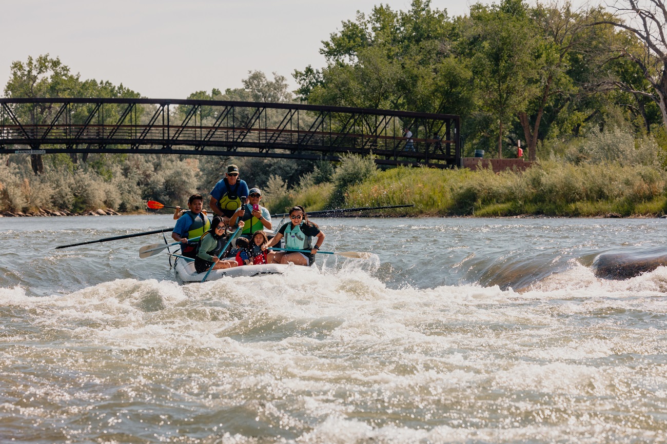
Paddlers rafting on the Animas River near Farmington, New Mexico.
New Mexico routeAztec / FarmingtonAnimas RiverAnimas Park landing to Boyd Park landingA city-access Animas float from Animas Park to the documented Boyd Park trailer landing in Farmington.

Route facts

Moderate | About 5.5 river miles | Allow 2–4 hours with bridge and current scouting | Live score supportedofficial source support
Paddlers rafting on the Animas River near Farmington, New Mexico.
New Mexico routeAztec / FarmingtonAnimas RiverAztec Riverside Park to Animas Park landingA longer Animas paddle trail combining the Riverside Park to Penny Lane and Penny Lane to Animas Park sections.

Route facts

Moderate | About 12.8 river miles | Allow 5–8 hours with diversion scouting and shuttle margin | Live score supportedofficial source support
Paddlers rafting on the Animas River near Farmington, New Mexico.
New Mexico routeAztec / FarmingtonAnimas RiverAztec Riverside Park to Boyd Park landingThe full documented Aztec-to-Farmington Animas paddle trail from Riverside Park to Boyd Park.

Route facts

Moderate | About 18.3 river miles | Allow 7–10 hours with scouting, diversion portages and shuttle margin | Live score supportedofficial source support

New Mexico beginner routes

These routes are tagged easy in the route data. Today's water can still change the call.

Showing 8 of 13 beginner routes. Use the Easy difficulty filter below to see the full set.

Routes with practical logistics

Use the live weekend board for score-based recommendations.

Rivers and regions

Expand a river or region to browse its routes.

By river

Rio Grande14
San Juan River11
Animas River10
Rio Chama3

By region

Albuquerque / Rio Grande Valley State Park3
Aztec / Farmington10
Rio Arriba County / Chama River Canyon3
Rio Grande Bosque / Embudo1
San Juan River / Farmington city access chain1
San Juan River / Farmington to Kirtland2
San Juan River / Navajo Dam to Farmington6
San Juan River / Vereda del Rio to Farmington1
San Juan River / Vereda del Rio to Kirtland1
Taos County / La Junta1
Taos County / Rio Grande del Norte7
Taos County / Ute Mountain Run2

Every New Mexico route on Paddle Today

38 routes with condition and access details.

Showing all 38 routes.

Animas RiverAnimas Park landing to Boyd Park landingAztec / Farmington | Moderate | Live score supportedAnimas RiverAztec Riverside Park to Animas Park landingAztec / Farmington | Moderate | Live score supportedAnimas RiverAztec Riverside Park to Boyd Park landingAztec / Farmington | Moderate | Live score supportedAnimas RiverAztec Riverside Park to Penny Lane landingAztec / Farmington | Moderate | Live score supportedAnimas RiverCedar Hill 550 Bridge County Boat Ramp to Animas Park landingAztec / Farmington | Moderate | Live score supportedAnimas RiverCedar Hill 550 Bridge County Boat Ramp to Aztec Riverside ParkAztec / Farmington | Moderate | Live score supportedAnimas RiverCedar Hill 550 Bridge County Boat Ramp to Boyd Park landingAztec / Farmington | Moderate | Live score supportedAnimas RiverCedar Hill 550 Bridge County Boat Ramp to Penny Lane landingAztec / Farmington | Moderate | Live score supportedAnimas RiverPenny Lane landing to Animas Park landingAztec / Farmington | Moderate | Live score supportedAnimas RiverPenny Lane landing to Boyd Park landingAztec / Farmington | Moderate | Live score supportedRio ChamaChavez Canyon to Big EddyRio Arriba County / Chama River Canyon | Moderate | Live score supportedRio ChamaEl Vado Ranch to Big EddyRio Arriba County / Chama River Canyon | Moderate | Live score supportedRio ChamaEl Vado Ranch to Chavez CanyonRio Arriba County / Chama River Canyon | Moderate | Live score supportedRio GrandeCalabacillas Arroyo access to Central Avenue accessAlbuquerque / Rio Grande Valley State Park | Easy | Live score supportedRio GrandeCalabacillas Arroyo access to Rio Bravo Boulevard accessAlbuquerque / Rio Grande Valley State Park | Easy | Live score supportedRio GrandeCentral Avenue access to Rio Bravo Boulevard accessAlbuquerque / Rio Grande Valley State Park | Easy | Live score supportedRio GrandeCounty Line BLM Site to Embudo gauging-station public accessRio Grande Bosque / Embudo | Easy | Live score supportedRio GrandeJohn Dunn Bridge / Cebolla Mesa access to Taos Junction Bridge (Lower Taos Box)Taos County / Rio Grande del Norte | Hard | Planning only · no live scoreRio GrandeLobatos Bridge, Colorado to Lee Trail, New MexicoTaos County / Ute Mountain Run | Moderate | Live score supportedRio GrandeLone Juniper Site to County Line River Access (Racecourse)Taos County / Rio Grande del Norte | Moderate | Live score supportedRio GrandeLone Juniper Site to Quartzite River AccessTaos County / Rio Grande del Norte | Moderate | Live score supportedRio GrandeQuartzite River Access to County Line River Access (Racecourse)Taos County / Rio Grande del Norte | Moderate | Live score supportedRio GrandeRed River confluence to John Dunn Bridge (La Junta)Taos County / La Junta | Hard | Live score supportedRio GrandeStateline BLM access to Lee Trail, New MexicoTaos County / Ute Mountain Run | Moderate | Live score supportedRio GrandeTaos Junction Bridge to County Line River AccessTaos County / Rio Grande del Norte | Moderate | Live score supportedRio GrandeTaos Junction Bridge to Lone Juniper SiteTaos County / Rio Grande del Norte | Moderate | Live score supportedRio GrandeTaos Junction Bridge to Quartzite River AccessTaos County / Rio Grande del Norte | Moderate | Live score supportedSan Juan RiverAmong the Waters Park public access to Kirtland Lions Park public river accessSan Juan River / Farmington to Kirtland | Easy | Live score supportedSan Juan RiverAmong the Waters Park public access to Westland Park public river accessSan Juan River / Farmington city access chain | Easy | Live score supportedSan Juan RiverBlanco public access to Among the Waters Park public accessSan Juan River / Navajo Dam to Farmington | Easy | Live score supportedSan Juan RiverBlanco public access to Vereda del Rio public launchSan Juan River / Navajo Dam to Farmington | Easy | Live score supportedSan Juan RiverNavajo Dam public launch to Among the Waters Park public accessSan Juan River / Navajo Dam to Farmington | Easy | Live score supportedSan Juan RiverNavajo Dam public launch to Blanco public accessSan Juan River / Navajo Dam to Farmington | Easy | Live score supportedSan Juan RiverNavajo Dam public launch to Vereda del Rio public launchSan Juan River / Navajo Dam to Farmington | Easy | Live score supportedSan Juan RiverVereda del Rio public launch to Among the Waters Park public accessSan Juan River / Navajo Dam to Farmington | Easy | Live score supportedSan Juan RiverVereda del Rio public launch to Kirtland Lions Park public river accessSan Juan River / Vereda del Rio to Kirtland | Moderate | Live score supportedSan Juan RiverVereda del Rio public launch to Westland Park public river accessSan Juan River / Vereda del Rio to Farmington | Moderate | Live score supportedSan Juan RiverWestland Park public river access to Kirtland Lions Park public river accessSan Juan River / Farmington to Kirtland | Easy | Live score supported

New Mexico paddling FAQ

How does Paddle Today choose New Mexico paddle routes?

Paddle Today lists source-backed routes with reviewed access and trip information. This page includes 37 routes with live-score support and 1 planning-only routes across 4 rivers. Planning-only routes do not have a live route score.

Are these New Mexico river conditions live?

Scored routes show the latest available conditions, subject to data availability. Planning-only routes provide trip information and source links without a live route score. Check update times and missing-data notices, and verify conditions with the linked managers before leaving.

Can I request another New Mexico route?

Yes. Use the request form to send the river, reach, access points, and any source links. Requests help prioritize useful additions with verified public access and route evidence.