
See all 2 routes on East Branch Delaware River
New York | Delaware County
East Branch Delaware RiverFish's Eddy DEC hand launch to Cadosia DEC hand launch / Hancock East–West Branch forks
A nine-mile Class I East Branch Delaware River route from the NYSDEC Fish's Eddy hand launch toward the Hancock forks, with a verifiable NYSDEC Cadosia hand-launch take-out just above the East/West Branch junction. The route preserves the route source's 200–3,000 cfs planning range while using live USGS 01421500 at Hancock as an explicitly labeled same-river proxy because the historical Fish's Eddy station is not currently returning a usable reading.
Checking current river conditions…
Route location
Loading the route map.
Need to know
Why this call

Route overview
Trip details
Access rules, camping, seasonal conditions and trip length.
Distance, difficulty, rules and camping
Plan ahead
Tomorrow and the weekend
Forecasts can change. Check current conditions again before leaving.
Waiting on forecast.
Waiting on forecast.
Plan
Plan your trip
Launch points, shuttle details, distance, and access notes.
Route logistics
Access and shuttle
A nine-mile Class I East Branch Delaware River route from the NYSDEC Fish's Eddy hand launch toward the Hancock forks, with a verifiable NYSDEC Cadosia hand-launch take-out just above the East/West Branch junction. The route preserves the route source's 200–3,000 cfs planning range while using live USGS 01421500 at Hancock as an explicitly labeled same-river proxy because the historical Fish's Eddy station is not currently returning a usable reading.
Access map
Put-in
Fish's Eddy DEC hand launchDEC's Fish's Eddy and Cadosia listings are hand launches, not trailer ramps; parking is limited to approximately five and four cars respectively.
Take-out
Cadosia DEC hand launch / Hancock forks approachThe route source targets the Hancock East/West Branch junction, while Cadosia is the clearly listed DEC public hand launch immediately above that transition. Use Cadosia for the product endpoint unless the junction landing and parking are independently verified.
Road shuttle
Access notes and hazards
Access caveats
- DEC's Fish's Eddy and Cadosia listings are hand launches, not trailer ramps; parking is limited to approximately five and four cars respectively.
- The route source targets the Hancock East/West Branch junction, while Cadosia is the clearly listed DEC public hand launch immediately above that transition. Use Cadosia for the product endpoint unless the junction landing and parking are independently verified.
- The East Branch shoreline includes posted and private property. Public navigation does not create blanket bank access, camping rights, or an emergency landing entitlement on private land.
Watch for
- USGS 01421500 below 200 cfs, above 3,000 cfs, rising quickly, unavailable, or inconsistent with the Fishs Eddy visual
- stale/unavailable USGS 01421000 data, low-water gravel, cold water, strainers, debris, bridge approaches, and changing current
- five-car Fishs Eddy parking, four-car Cadosia parking, private banks, angler activity, limited bailout options, and the Hancock forks boundary
Plan this paddle
Choose your trip times
No account needed. Check the selected access points above, then choose both dates and times. For an overnight paddle, set take-out to the following date.
Times use the selected time zone. Check it against the river’s location before saving or sharing.
Browser plans stay on this device. Sharing opens your device’s share tools or gives you text to copy.
Download GPX Route geometry only; no schedule required.
Conditions
Water levels, gauge history, and hourly forecast
Check the forecast and local water levels before launching.
USGS measurements
More about this gauge
These measurements come from the gauge station. Water depth and current can differ along your trip.
River camera · USGS
View at the gauge
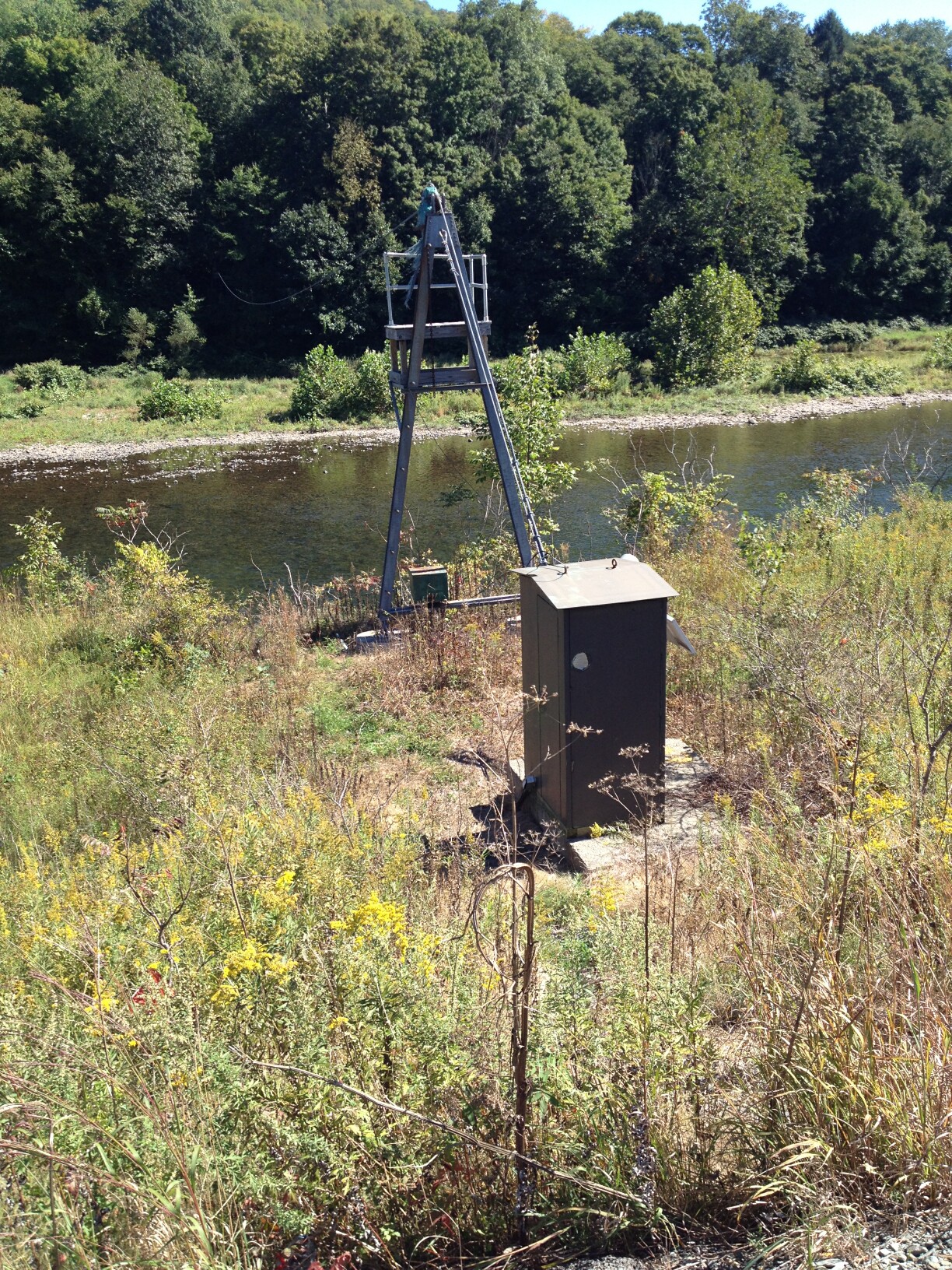
East Branch Delaware River at Hancock, NY. This view may be outside your paddling reach. Images are periodic and do not establish safe conditions.
Gauge detail
Water-level history and forecastDetailed view
Gauge
Recent trend
Checking preferred range.
Checking trend.
Gauge source
--Checking timestampWeather
Hourly forecast
Checking weather.
Loading today's forecast.
Next 8 hours
Short-route forecast
Checking the next several hours.
Route gallery
Photos
Check each caption: some photos show the surrounding area rather than this exact trip.
Sources
Data and sources
Read the access and hazard notes and check the linked guides. We do not issue a daily score for this trip.
NotesWhat to know before you go
These notes cover the access details, route quirks, and source caveats most likely to matter once you get there.
- Named New York corridorFish's Eddy to Hancock; 9 miles; Class I
CanWePaddle publishes the named reach, approximate distance, Class I character, four-hour float time, April–October season, endpoint target, and conservative 200–3,000 cfs planning range.
- Public water accessNYSDEC Fish's Eddy and Cadosia East Branch hand launches
NYSDEC lists both endpoint-area sites as Delaware River (East Branch) hand launches and publishes their coordinates and limited parking capacities.
- Proxy flow guidance200–3,000 cfs estimated range using live USGS 01421500 at Hancock as a near-endpoint same-river proxy
The numeric range comes from the route source’s Fishs Eddy section; the live Hancock station is retained transparently as a proxy and does not replace a local visual, rainfall, or trend check.
- Historical route gauge caveatUSGS 01421000 at Fishs Eddy is the route source station but currently has no usable current reading
USGS describes the Fishs Eddy station and its location upstream of the East/West Branch confluence; check it when available, but do not present stale or unavailable data as live telemetry.
- Cold-water and private-bank safetyCold tailwater, private shorelines, local scouting, PFD, and public-access-only landings
Upper Delaware river-safety guidance requires local condition checks and respect for private shoreline and public access boundaries.
- Same-river proxy gaugeUSGS 01421500, East Branch Delaware River at Hancock, NY
USGS provides continuous telemetry at a same-river downstream proxy; local rainfall, tributary inflow, and dam operations can make route conditions diverge.
- Safety and river conditionsCheck live gauge, recent rainfall, trend, debris, bridges, and access conditions before launch
CanWePaddle / NYSDEC Delaware County public access / USGS Hancock proxy and its linked safety material warn that conditions change rapidly and require local inspection.
- Image decisionApproved watershed/proxy-gauge context image used for route presentation
The image is clearly labeled as watershed/proxy-gauge context and does not claim to depict this exact reach.
Verify it yourselfCheck the source links
Use these links to double-check the gauge, route details, and access notes before you head out.
- CanWePaddle / NYSDEC Delaware County public access / USGS Hancock proxy route record
- NYSDEC Delaware County East Branch launch listings
- CanWePaddle Fishs Eddy to Hancock conditions
- National Park Service Upper Delaware river safety guidance
- USGS 01421500 monitoring location
- USGS 01421500 current conditions
- East Branch Delaware River context image
Paddler reports
Recent notes from paddlers
A few quick notes from people who were on this route recently.
Reports
Paddler reports
See recent photos and notes from people on the route.
Share your trip
Keep exploring
More routes to check next
Compare another stretch on this river, or explore different rivers within 75 straight-line miles.
More in New York
All 282 routesMore on East Branch Delaware River
All 2Nearby routes within 75 miles
Quick answers
East Branch Delaware River paddling FAQ
What water level is best for the Fish's Eddy DEC hand launch to Cadosia DEC hand launch / Hancock East–West Branch forks route on the East Branch Delaware River?
This planning route has no live Paddle Today score. Review the linked water-level sources, current access notices and route-specific hazards before travel.
Where does the Fish's Eddy DEC hand launch to Cadosia DEC hand launch / Hancock East–West Branch forks route on the East Branch Delaware River start and end?
This route starts at Fish's Eddy DEC hand launch and ends at Cadosia DEC hand launch / Hancock forks approach, 9 river miles to the Hancock forks; use the Cadosia DEC hand launch as the verified public take-out unless the final junction landing is separately confirmed on the water.
Is the Fish's Eddy DEC hand launch to Cadosia DEC hand launch / Hancock East–West Branch forks route on the East Branch Delaware River suitable for beginners?
This is listed as a easy route. Review the difficulty notes, hazards and current access conditions against your group's skills. No live score assesses this trip.
Flag a change
See something outdated?
Access, hazards, wood, and shuttle details change. Send a quick correction if something looks off.