
See all 11 routes on Kansas River
Kansas | Northeast Kansas
Kansas River
Junction City / Grant Park to Manhattan K-177 / Fairmont
Route planning details, access notes, and local verification guidance.
Route location
Loading the route coverage map.
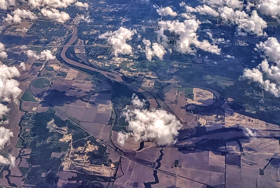
Need to know
Why this call

Conditions
Gauge history and hourly forecast
Use the gauge context and hourly forecast to verify local conditions before launching.
Gauge detail
Gauge history & hourly forecastDetailed view
Gauge
Recent trend
Checking preferred range.
Checking trend.
Gauge source
--Checking timestampMN DNR provides the current paddling level here, but not chart-ready recent samples.
Weather
Hourly forecast
Checking weather.
Loading today's forecast.
Next 8 hours
Short-route forecast
Checking the next several hours.
Route overview
Quick facts and what's next
Distance, difficulty, shuttle basics, and the near-term outlook before you commit to the drive.
Quick facts
Plan ahead
Upcoming outlook
These are early planning reads. Re-check live conditions before you commit to the drive.
Waiting on forecast.
Waiting on forecast.
Plan
Plan your trip
Launch points, shuttle details, distance, and access notes.
Route logistics
Access and shuttle
Launch at Grant Park in Junction City and take out at the Manhattan K-177 / Fairmont ramp for a long upper-Kaw continuation. The app uses the downstream Wamego gauge as a same-river proxy and expects the current route score to stay conservative when the proxy sits above the broad Kansas comfort band.
Prepare this trip
Take the plan with you
Download the canonical route, add a calendar hold, or send a simple float plan to your group.
Put-in
Junction City Access Ramp / Grant ParkThe Junction City ramp is on the Republican River, not directly on the Kansas River. The Kansas River begins about one-third mile downstream where the Republican and Smoky Hill meet.
Take-out
Manhattan K-177 / Fairmont Access RampThe Manhattan K-177 / Fairmont ramp has limited parking and can have a sandbar at the toe, so inspect the landing angle before leaving the shuttle vehicle.
Plan this segment
Access caveats and watch for
Access caveats
- The Junction City ramp is on the Republican River, not directly on the Kansas River. The Kansas River begins about one-third mile downstream where the Republican and Smoky Hill meet.
- The Manhattan K-177 / Fairmont ramp has limited parking and can have a sandbar at the toe, so inspect the landing angle before leaving the shuttle vehicle.
- Stay with public ramps and legal sandbar stops between the high-water marks. The banks above the river are private property.
- All access and parking are subject to same-day city, county, mud, silt, high-water cleanup, and event conditions.
Watch for
- Unusual currents at the Republican and Smoky Hill confluence near the start.
- Low flows below about 1,000 cfs can make the channel narrow and sandbar navigation slow or technical.
- Flows above 5,000 cfs are outside the novice band, and above 8,000 cfs Friends of the Kaw says sandbar rest stops become scarce.
- Wind across open bends, storms, rising water, floating wood, strainers, and bank hooks or fishing lines left in shoreline trees.
- Private banks along the Kaw; do not plan on using them for rest, camping, or bailout access.
Route gallery
See this route on the water
Photos help show what the access looks like and what the route actually feels like on the water.
Score & sources
Data and sources
See the gauge, weather, and source notes behind today's call.
Why this scoreToday's evidence strength is checking
Evidence strength mostly comes down to three things: how direct the active gauge is, how clear the range is, and how fresh the data is.
- Checking evidence-strength notes.
- Checking evidence cautions.
Data behind the scoreGauge, thresholds, and timing
These are the live readings and threshold notes behind today's score.
| Gauge site | Kansas River at Wamego, KS |
| Discharge | Checking |
| Gauge height | Checking |
| 24h trend | Checking |
| 24h change | Checking |
| Current band | Checking |
| Rain last 24h | Checking |
| Rain last 72h | Checking |
| Air temp | Checking |
| Water temp | Checking |
| Wind | Checking |
| Gusts | Checking |
| Rain timing | Checking |
| Target band | 1,500 cfs to 5,000 cfs |
| Low threshold | 1,000 cfs |
| High threshold | 8,000 cfs |
| Evidence strength behind the range | Official and local sources |
| Gauge observed | Checking |
| Paddle Today updated | Checking |
| Main source behind this score | Friends of the Kaw safety bands and USACE Kansas River recreation flow impacts |
| Gauge source | Checking |
| Weather source | Checking |
| Rainfall source | Checking |
NotesWhat to know before you go
These notes cover the access details, route quirks, and source caveats most likely to matter once you get there.
- Public put-inJunction City / Grant Park, RM 173
Friends of the Kaw lists Junction City Access Ramp in Grant Park with GPS 39.06029, -96.80341 on the Republican River about one-third mile above the Smoky Hill confluence where the Kansas River begins.
- Public take-outManhattan K-177 / Fairmont, RM 150.7
Friends of the Kaw lists the Manhattan K-177 / Fairmont ramp below the K-177 bridge with GPS 39.17428, -96.55318 and public parking at the take-out.
- Route distanceAbout 23 mi
Friends of the Kaw says Junction City to Ogden is a little over 9 miles and Ogden to Manhattan is about 14 miles, which supports this longer combined public route.
- Direct live proxy readingWamego gauge 18,800 cfs / 10.60 ft
USGS Water Services returned 18,800 cfs and 10.60 ft at 2026-06-26 11:30 CDT for Kansas River at Wamego, the downstream same-river proxy used for this route.
- Flow safety bands1,000 / 1,500-5,000 / 8,000 cfs
Friends of the Kaw recommends novice paddlers stay below 5,000 cfs and everyone else below 8,000 cfs, while USACE recreation guidance supports the difficult-below-1,000 and no-impact 1,500-5,000 calibration.
- Confluence and release caveatsRepublican/Smoky Hill line plus Big Blue context
The Junction City page warns about unusual currents where the Republican meets the Smoky Hill, and the Manhattan page warns that nearby Blue River access can be affected when Tuttle Creek releases exceed 500 cfs.
- Camping supportPublic sandbar camping between high-water marks
Friends of the Kaw says the Kansas River is public, sandbar camping is allowed without a special permit, and private banks above the high-water mark remain off-limits.
Verify it yourselfCheck the source links
Use these links to double-check the gauge, route details, and access notes before you head out.
- Friends of the Kaw Kansas River access map
- Friends of the Kaw Junction City access
- Friends of the Kaw Ogden access
- Friends of the Kaw Manhattan K-177 / Fairmont access
- Friends of the Kaw Paddle FAQ
- Friends of the Kaw camping on the Kaw
- USACE Kansas River recreation appendix
- USGS 06887500 Kansas River at Wamego
Paddler reports
Recent notes from paddlers
A few quick notes from people who were on this route recently.
Reports
Paddler reports
See recent photos and notes from people on the route.
Share your trip
Keep exploring
More routes to check next
Compare another stretch on this river, or jump to nearby options before you pick a plan.
Quick answers
Kansas River paddling FAQ
What water level is good for paddling Kansas River?
Paddle Today watches Kansas River at Wamego, KS and treats 1,500 cfs to 5,000 cfs as the target band for this route, with weather and recent trend included in the final score.
Where does this Kansas River route start and end?
This route starts at Junction City Access Ramp / Grant Park and ends at Manhattan K-177 / Fairmont Access Ramp, about About 23 mi on the water.
Is this Kansas River route good for beginners?
This is listed as a hard route. Treat the live score as a planning aid, then confirm conditions, hazards, access, and group skill before launching.
Flag a change
See something outdated?
Access, hazards, wood, and shuttle details change. Send a quick correction if something looks off.