
Delaware | Sussex County / Delaware Seashore State Park
Rehoboth BaySavages Ditch Road to New Road water trail
An advanced, approximately four-mile Rehoboth Bay water-trail course from the Delaware Seashore State Park Savages Ditch kayak launch to the New Road access area, with an official same-launch loop or out-and-back option.
Checking current river conditions…
Route location
Loading the route map.
Need to know
Why this call

Route overview
Trip details
Access rules, camping, seasonal conditions and trip length.
Distance, difficulty, rules and camping
Plan ahead
Tomorrow and the weekend
Forecasts can change. Check current conditions again before leaving.
Waiting on forecast.
Waiting on forecast.
Plan
Plan your trip
Launch points, shuttle details, distance, and access notes.
Route logistics
Access and shuttle
An experienced-only four-mile Rehoboth Bay water-trail course with official park access at Savages Ditch and New Road, tide/wind dependence, seasonal waterfowl restrictions, and a same-launch return option.
Access map
Put-in
Delaware Seashore State Park Savages Ditch kayak launchThe official map supplies park access and route anchors, not a guarantee of a launch-ready wetted edge, open gate, parking, fee status, or current channel clearance. Verify conditions at both ends immediately before travel.
Take-out
Delaware Seashore State Park New Road access areaThe route map’s approximately four-mile distance is a planning figure; channel choice, tide, water level, wind, and marsh conditions can change the practical line and paddling time.
Road shuttle
Access notes and hazards
Access caveats
- The official map supplies park access and route anchors, not a guarantee of a launch-ready wetted edge, open gate, parking, fee status, or current channel clearance. Verify conditions at both ends immediately before travel.
- The route map’s approximately four-mile distance is a planning figure; channel choice, tide, water level, wind, and marsh conditions can change the practical line and paddling time.
- The map specifically notes active waterfowl hunting from October through February and asks paddlers to respect nesting habitat and private property. Current closure signs and park staff direction override the route card.
- The stored coordinates are public park access/parking anchors with uncertainty, not surveyed launch-edge points. Do not infer public landings at islands, beaches, private banks, docks, jetties, bridges, or the Indian River inlet.
Watch for
- NOAA 8558690 Indian River Inlet tide predictions, USGS 01484670 Rehoboth Bay proxy context, local wind/marine forecast, heat, recent weather, visibility, water level, and daylight
- Savages Ditch kayak-launch condition, New Road access/carry, park entry and parking/fee status, posted closures, waterfowl hunting October–February, nesting habitat, and private shoreline
- shallow/muddy marsh channels, narrow turns, submerged vegetation, marsh debris, reversing current, wind waves, inlet/marina boat traffic, limited lawful bailout, shuttle keys, and same-launch return margin
Plan this paddle
Choose your trip times
No account needed. Check the selected access points above, then choose both dates and times. For an overnight paddle, set take-out to the following date.
Times use the selected time zone. Check it against the river’s location before saving or sharing.
Browser plans stay on this device. Sharing opens your device’s share tools or gives you text to copy.
Download GPX Route geometry only; no schedule required.
Conditions
Water levels, gauge history, and hourly forecast
Check the forecast and local water levels before launching.
USGS measurements
More about this gauge
These measurements come from the gauge station. Water depth and current can differ along your trip.
River camera · USGS
View at the gauge
Rehoboth Bay at Dewey Beach, DE. This view may be outside your paddling reach. Images are periodic and do not establish safe conditions.
Gauge detail
Water-level history and forecastDetailed view
Gauge
Recent trend
Checking preferred range.
Checking trend.
Gauge source
--Checking timestampWeather
Hourly forecast
Checking weather.
Loading today's forecast.
Next 8 hours
Short-route forecast
Checking the next several hours.
Route gallery
Photos
Check each caption: some photos show the surrounding area rather than this exact trip.
Sources
Data and sources
Read the access and hazard notes and check the linked guides. We do not issue a daily score for this trip.
NotesWhat to know before you go
These notes cover the access details, route quirks, and source caveats most likely to matter once you get there.
- Named moving-water corridorDelaware State Parks Savages Ditch Road to New Road Rehoboth Bay water trail
The official park water-trail map names the approximately four-mile course, identifies Savages Ditch and New Road, and provides a loop/out-and-back alternative from either access. This record preserves the bounded park course and does not claim the inlet, ocean, or broader Indian River Bay.
- Authoritative public endpoint evidenceDelaware Seashore State Park Savages Ditch kayak launch and New Road access area
Delaware State Parks’ current map marks the park access/parking locations and describes the launch-to-finish course. Coordinates are official park anchors rather than surveyed wetted-edge points; verify carry, waterline, gate, parking, fee, and closure status in the field.
- Proxy tidal-flow evidenceUSGS 01484670 Rehoboth Bay at Dewey Beach, DE, with NOAA 8558690 Indian River Inlet tide predictions
The USGS station is clearly labeled same-estuary proxy context and NOAA provides the local tide reference. Combine both with current wind, marine forecast, observed water level, channel depth, and route-specific judgment; no numeric cutoff is transferred.
- Route-specific safety and seasonal guidanceDelaware State Parks water-trail map and Paddle Coastal Delaware Rehoboth Bay zone guidance
The park map classifies the course for experienced kayakers, warns about heat, wind, and tide, identifies nesting/private-property controls, and closes the area to recreational use during October–February waterfowl season. The regional trail guide adds local tide, weather, fee/parking, and inlet-traffic context.
- Camping postureNearby basecamp only
The route uses day-use park access. Separate Delaware Seashore State Park campground reservations may be available, but no campsite, overnight moorage, marsh-island landing, or private-shore camping is claimed by this route.
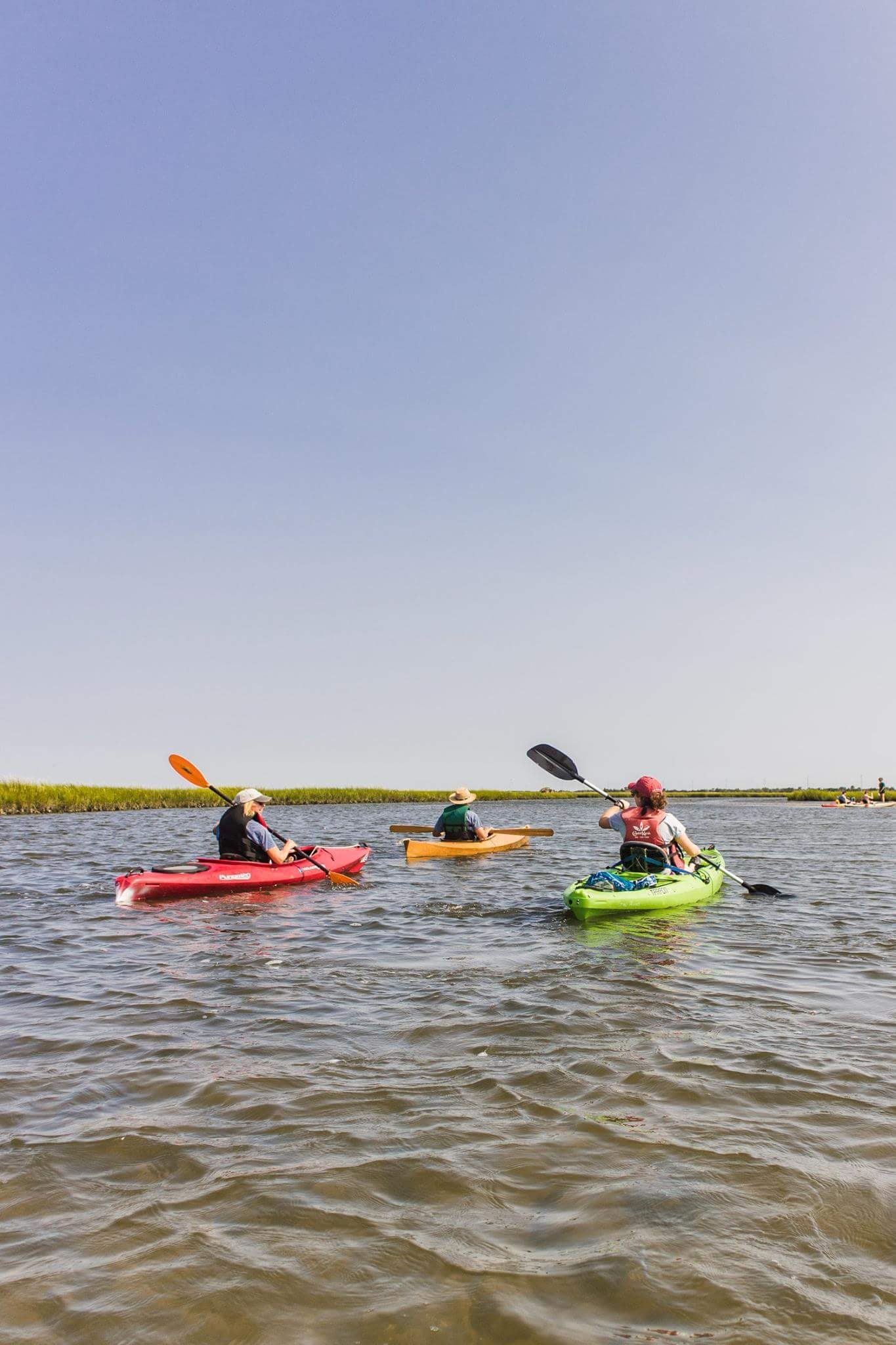
- Approved route imageryState of Delaware Paddlefest Rehoboth Bay salt-marsh photograph
The official State of Delaware Paddlefest image supplies route-context imagery for the same Delaware Seashore salt-marsh paddling setting; it does not certify current access, tide, channel condition, seasonal opening, or endpoint landing.
Verify it yourselfCheck the source links
Use these links to double-check the gauge, route details, and access notes before you head out.
Paddler reports
Recent notes from paddlers
A few quick notes from people who were on this route recently.
Reports
Paddler reports
See recent photos and notes from people on the route.
Share your trip
Keep exploring
More routes to check next
Compare another stretch on this river, or explore different rivers within 75 straight-line miles.
More in Delaware
All 16 routesNearby routes within 75 miles
Quick answers
Rehoboth Bay paddling FAQ
What water level is best for the Savages Ditch Road to New Road water trail route on the Rehoboth Bay?
This planning route has no live Paddle Today score. Review the linked water-level sources, current access notices and route-specific hazards before travel.
Where does the Savages Ditch Road to New Road water trail route on the Rehoboth Bay start and end?
This route starts at Delaware Seashore State Park Savages Ditch kayak launch and ends at Delaware Seashore State Park New Road access area, Approximately 4 tidal salt-marsh miles from Savages Ditch Road to New Road; official park map also permits a loop or out-and-back from either access point on the water.
Is the Savages Ditch Road to New Road water trail route on the Rehoboth Bay suitable for beginners?
This is listed as a hard route. Review the difficulty notes, hazards and current access conditions against your group's skills. No live score assesses this trip.
Flag a change
See something outdated?
Access, hazards, wood, and shuttle details change. Send a quick correction if something looks off.